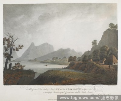
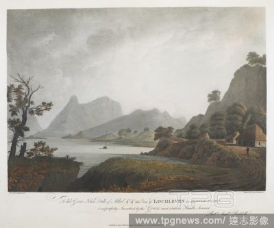
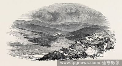
EditorialA figure on a path by buildings on the right-hand side; a boat on the water to the left; mountains in the distance; trees and rocks throughout the scene. To his Grace John Duke of Athol &c &c this View of LOCHLEVEN in ARGYLE-SHIRE, is respectfully Insc...
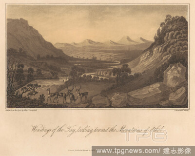
EditorialWindings of the Tay, Looking toward the Mountains of Athol, Print made by Thomas Medland, 17551823, British, after Alexander Campbell, 17641824, British, Published by Longman, active 18041914, British, 1802, Aquatint on medium, slightly textured, cream...
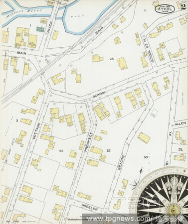
EditorialImage 7 of Sanborn Fire Insurance Map from Athol, Worcester County, Massachusetts. Apr 1892. 10 Sheet(s), America, street map with a Nineteenth Century compass.
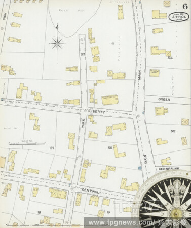
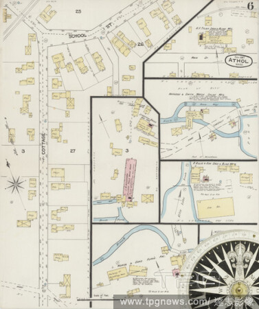
EditorialImage 6 of Sanborn Fire Insurance Map from Athol, Worcester County, Massachusetts. Apr 1892. 10 Sheet(s), America, street map with a Nineteenth Century compass.
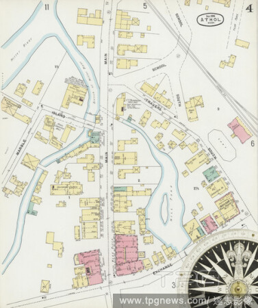
EditorialImage 4 of Sanborn Fire Insurance Map from Athol, Worcester County, Massachusetts. Apr 1892. 10 Sheet(s), America, street map with a Nineteenth Century compass.
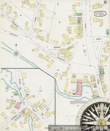
EditorialImage 8 of Sanborn Fire Insurance Map from Athol, Worcester County, Massachusetts. Dec 1896. 12 Sheet(s), America, street map with a Nineteenth Century compass.
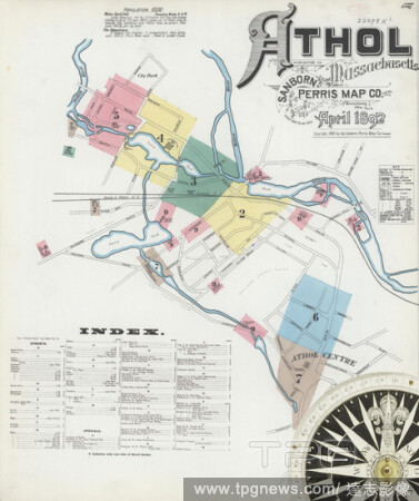
EditorialImage 1 of Sanborn Fire Insurance Map from Athol, Worcester County, Massachusetts. Apr 1892. 10 Sheet(s), America, street map with a Nineteenth Century compass.
EditorialImage 12 of Sanborn Fire Insurance Map from Athol, Worcester County, Massachusetts. Dec 1896. 12 Sheet(s), America, street map with a Nineteenth Century compass.
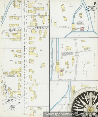
EditorialImage 8 of Sanborn Fire Insurance Map from Athol, Worcester County, Massachusetts. Apr 1892. 10 Sheet(s), America, street map with a Nineteenth Century compass.
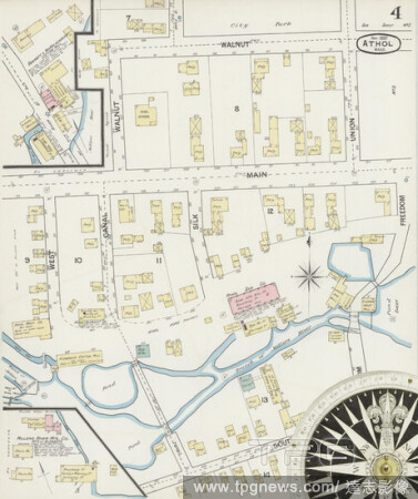
EditorialImage 4 of Sanborn Fire Insurance Map from Athol, Worcester County, Massachusetts. Dec 1896. 12 Sheet(s), America, street map with a Nineteenth Century compass.
EditorialImage 1 of Sanborn Fire Insurance Map from Athol, Worcester County, Massachusetts. Dec 1896. 12 Sheet(s), America, street map with a Nineteenth Century compass.
EditorialImage 9 of Sanborn Fire Insurance Map from Athol, Worcester County, Massachusetts. Apr 1892. 10 Sheet(s), America, street map with a Nineteenth Century compass.
EditorialImage 2 of Sanborn Fire Insurance Map from Athol, Worcester County, Massachusetts. Nov 1887. 6 Sheet(s), America, street map with a Nineteenth Century compass.
EditorialImage 4 of Sanborn Fire Insurance Map from Athol, Worcester County, Massachusetts. Nov 1887. 6 Sheet(s), America, street map with a Nineteenth Century compass.
EditorialImage 3 of Sanborn Fire Insurance Map from Athol, Worcester County, Massachusetts. Apr 1892. 10 Sheet(s), America, street map with a Nineteenth Century compass.
EditorialImage 3 of Sanborn Fire Insurance Map from Athol, Worcester County, Massachusetts. Nov 1887. 6 Sheet(s), America, street map with a Nineteenth Century compass.
EditorialImage 10 of Sanborn Fire Insurance Map from Athol, Worcester County, Massachusetts. Apr 1892. 10 Sheet(s), America, street map with a Nineteenth Century compass.
EditorialImage 6 of Sanborn Fire Insurance Map from Athol, Worcester County, Massachusetts. Dec 1896. 12 Sheet(s), America, street map with a Nineteenth Century compass.
EditorialImage 7 of Sanborn Fire Insurance Map from Athol, Worcester County, Massachusetts. Dec 1896. 12 Sheet(s), America, street map with a Nineteenth Century compass.
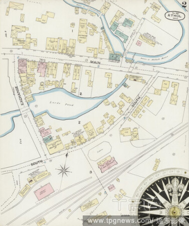
EditorialImage 2 of Sanborn Fire Insurance Map from Athol, Worcester County, Massachusetts. Apr 1892. 10 Sheet(s), America, street map with a Nineteenth Century compass.
EditorialImage 10 of Sanborn Fire Insurance Map from Athol, Worcester County, Massachusetts. Dec 1896. 12 Sheet(s), America, street map with a Nineteenth Century compass.
EditorialImage 5 of Sanborn Fire Insurance Map from Athol, Worcester County, Massachusetts. Apr 1892. 10 Sheet(s), America, street map with a Nineteenth Century compass.
EditorialImage 9 of Sanborn Fire Insurance Map from Athol, Worcester County, Massachusetts. Dec 1896. 12 Sheet(s), America, street map with a Nineteenth Century compass.
EditorialImage 1 of Sanborn Fire Insurance Map from Athol, Worcester County, Massachusetts. Nov 1887. 6 Sheet(s), America, street map with a Nineteenth Century compass.
EditorialImage 3 of Sanborn Fire Insurance Map from Athol, Worcester County, Massachusetts. Dec 1896. 12 Sheet(s), America, street map with a Nineteenth Century compass.
EditorialImage 11 of Sanborn Fire Insurance Map from Athol, Worcester County, Massachusetts. Dec 1896. 12 Sheet(s), America, street map with a Nineteenth Century compass.
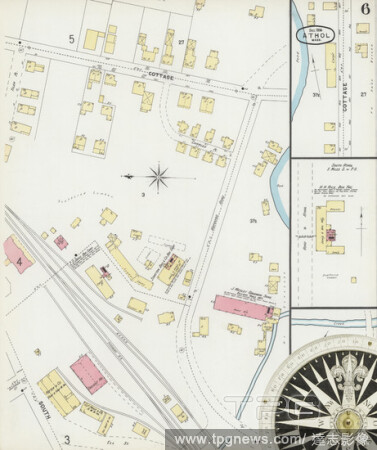
EditorialImage 5 of Sanborn Fire Insurance Map from Athol, Worcester County, Massachusetts. Dec 1896. 12 Sheet(s), America, street map with a Nineteenth Century compass.
EditorialImage 2 of Sanborn Fire Insurance Map from Athol, Worcester County, Massachusetts. Dec 1896. 12 Sheet(s), America, street map with a Nineteenth Century compass.
EditorialImage 6 of Sanborn Fire Insurance Map from Athol, Worcester County, Massachusetts. Nov 1887. 6 Sheet(s), America, street map with a Nineteenth Century compass.
EditorialA figure on a path by buildings on the right-hand side; a boat on the water to the left; mountains in the distance; trees and rocks throughout the scene. To his Grace John Duke of Athol &c &c this View of LOCHLEVEN in ARGYLE-SHIRE, is respectfully Insc...


 Loading