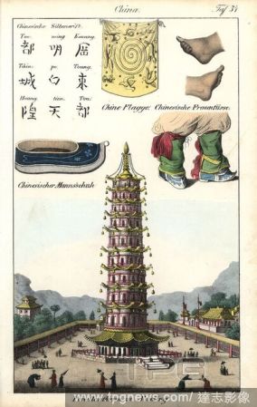
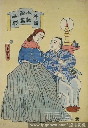
EditorialChinese flag, women's shoes and feet, men's shoe, Chinese writing characters and the Porcelain Pagoda at Nanking (Nanjing) built during the Ming dynasty. Handcoloured lithograph from Friedrich Wilhelm Goedsche's "Vollstaendige V?lkergallerie in getreue...
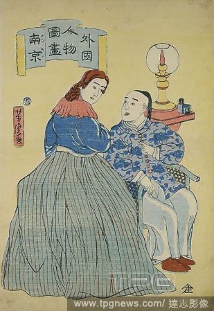
EditorialUtagawa Yoshitora, Chinese and Dutch woman from Nanking, color woodblock, Total: Height: 37,20 cm; Width: 25,50 cm, Signature: Yoshitora ga , Publisher: Yamadaya Shjir (Kinkyd), printmaking,printing, man, woman, peoples and nationalities, flame, Edo pe...
EditorialChinese flag, women's shoes and feet, men's shoe, Chinese writing characters and the Porcelain Pagoda at Nanking (Nanjing) built during the Ming dynasty. Handcoloured lithograph from Friedrich Wilhelm Goedsche's "Vollstaendige V?lkergallerie in getreue...
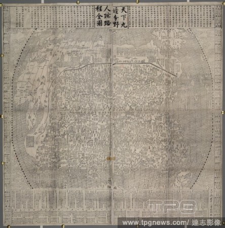
EditorialA map of China and neighbouring countries. Landmarks such as the Great Wall. Dated 1645. . Railway, Highway & Aviation Map of China. Nanking China. 1645 (Reconstruction in China.) Scale, 1,500[Li = 112 mm]. Source: Maps.*60875.(11). Language: Chinese.
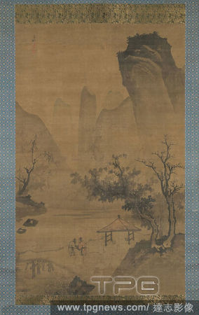
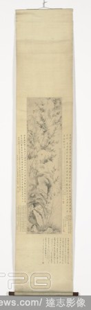
EditorialHanging scroll with bamboo and orchids on a rock, Hanging roll with bamboo and orchids on a rock. In wooden box., Ma Shouzhen, Nanking, c. 1548 - c. 1604, Ming-dynasty (1368-1644), paper, ink, h 121.8 cm ? w 31.8 cm w 513 mm w 624 mm d 48 mm d 38 mm h ...
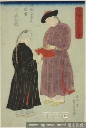
EditorialChinese Man from Nanking Admiring a Fan (Shincho Nankinjin kansho Koshu ogi no zu), from the series "Foreigners Drawn from Life (Ikiutsushi ikoku jinbutsu)". Utagawa Sadahide; Japanese, 1807-1873. Date: 1860. Dimensions: . Color woodblock print; oban. ...
EditorialChina. [Map of China and neighbouring Countries]. [Nanking], [1645]. Map of China and neighbouring Countries. Image taken from [Map of China and neighbouring Countries]. . Originally published/produced in [Nanking], [1645]. . Source: Maps.*60875.(11)...
EditorialA map of China and neighbouring countries. Landmarks such as the Great Wall. Dated 1645. . Railway, Highway & Aviation Map of China. Nanking China. 1645 (Reconstruction in China.) Scale, 1,500[Li = 112 mm]. Source: Maps.*60875.(11). Language: Chinese.
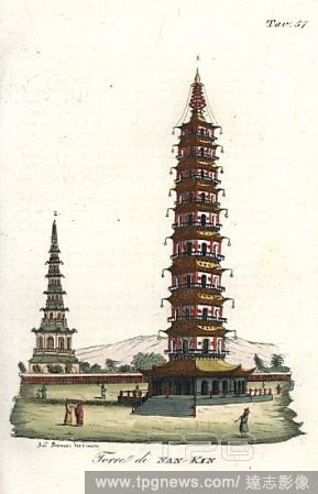
EditorialOctagonal nine-story porcelain tower in Nanjing (Nanking), China. Handcoloured illustration and copperplate engraving by Andrea Bernieri from Giulio Ferrrario's Costumes Antique and Modern of All Peoples (Il Costume Antico e Moderno di Tutti i Popoli),...
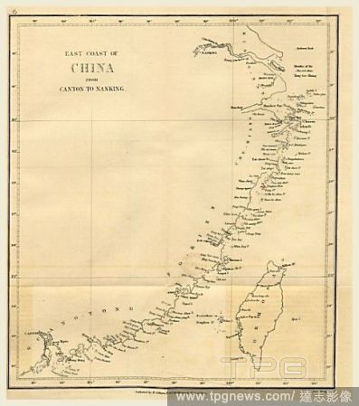
EditorialTopographical Map of the East coast of China from Canton to Nanking. Narrative of the Voyages and Services of the Nemesis, from 1840 to 1843, and of the combined naval and military operations in China, 19th century engraving.
EditorialChinese flag, women's shoes and feet, men's shoe, Chinese writing characters and the Porcelain Pagoda at Nanking (Nanjing) built during the Ming dynasty. Handcoloured lithograph from Friedrich Wilhelm Goedsche's "Vollstaendige V?lkergallerie in getreue...
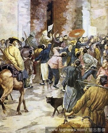
EditorialHistory of the Chinese Empire. 19th century. Opium War. Sino-British War between 1832 and 1842. Following the signing of the Peace of Nanking (1842) Great Britain managed to open the five-port shipping traffic and control of the island of Hong Kong. Co...


 Loading