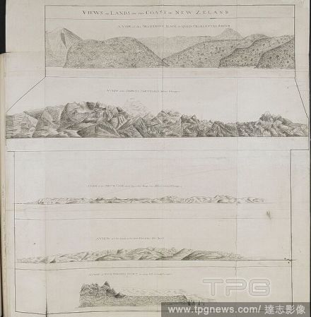
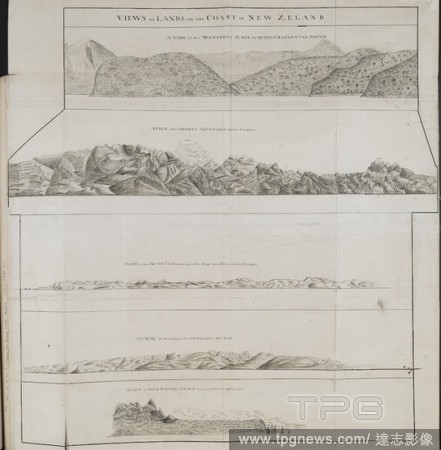
EditorialVarious views of headlands on the coasts of New Zealand; drawn by Lieut. James Cook, in his first voyage. Charts, Plans, Views, and Drawings taken on board the Endeavour during Captain Cook's First Voyage, 1768-1771. ca. 1769-1770. Source: Add. 7085, N...
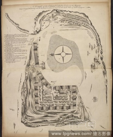
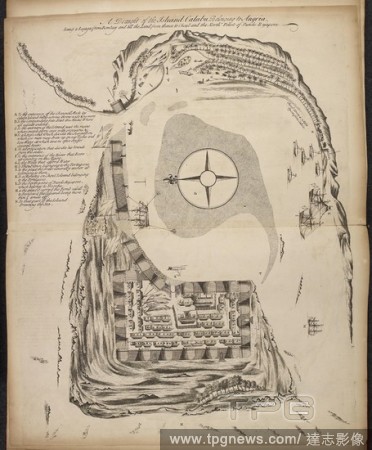
EditorialChart and picture of Savage island. Niue was first seen by Captain James Cook in 1774. He named the island "Savage Island". TWENTY-TWO Charts, views of Headlands, etc., taken during Captain Cook's voyage in the Resolution through the Pacific and South...
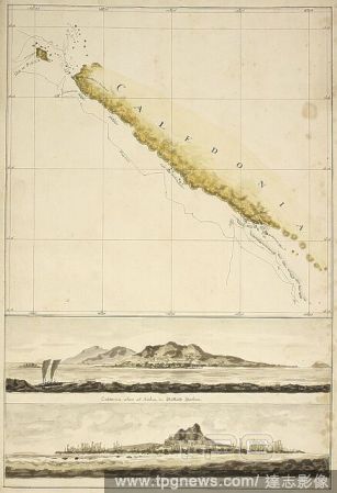
EditorialMap of New Caledonia, with two coastal views; Ballarde Harbour, and the Isle of Pines. October 1774. Charts, and views of headlands, taken during Captain Cook's Second Voyage, 1772-1774. Source: Add. 15500, No.14. Language: English.
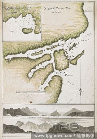
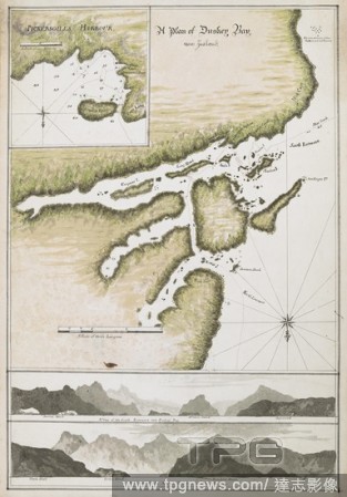
EditorialA Plan of Dusky Bay, New Zealand, 26 March-3 May 1773 Shows ship’s track. Detail of Pickersgills Harbour with Ships Cove, Astronomers Point and Crayfish Island.Panoramas of A View of the South Entrance into Duskey Bay and A View of the North Entranc...
EditorialIllsutration of harbour on the Indian coastline. . Observations upon several Voyages to India Out and Home. London, 1720. Observations upon several Voyages to India Out and Home; as also Remarks on the ports and places touched at in that Voyage ... Ill...
EditorialIllsutration of harbour on the Indian coastline. . Observations upon several Voyages to India Out and Home. London, 1720. Observations upon several Voyages to India Out and Home; as also Remarks on the ports and places touched at in that Voyage ... Ill...
EditorialVarious views of headlands on the coasts of New Zealand; drawn by Lieut. James Cook, in his first voyage. Charts, Plans, Views, and Drawings taken on board the Endeavour during Captain Cook's First Voyage, 1768-1771. ca. 1769-1770. Source: Add. 7085, N...
EditorialChart and picture of Savage island. Niue was first seen by Captain James Cook in 1774. He named the island "Savage Island". TWENTY-TWO Charts, views of Headlands, etc., taken during Captain Cook's voyage in the Resolution through the Pacific and South...
EditorialMap of New Caledonia, with two coastal views; Ballarde Harbour, and the Isle of Pines. October 1774. Charts, and views of headlands, taken during Captain Cook's Second Voyage, 1772-1774. Source: Add. 15500, No.14. Language: English.
EditorialA Plan of Dusky Bay, New Zealand, 26 March-3 May 1773 Shows ship’s track. Detail of Pickersgills Harbour with Ships Cove, Astronomers Point and Crayfish Island.Panoramas of A View of the South Entrance into Duskey Bay and A View of the North Entranc...
EditorialIllsutration of harbour on the Indian coastline. . Observations upon several Voyages to India Out and Home. London, 1720. Observations upon several Voyages to India Out and Home; as also Remarks on the ports and places touched at in that Voyage ... Ill...
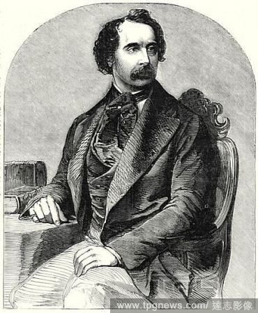
EditorialCharles Dickens, from a recent daguerreotype by Mayall, 1 December, 1855. . Memoir of Charles Dickens. . The lives of men of genius when happy, are ordinarily uneventful. It may, perhaps, be one of the reaspms for the paucity of materials available for...


 Loading