
filter
-
Brand
- By Category
- Direction
- Date Range
163Events
Pictures
Events

Editorial Notting Hill Carnival, London, UK., Notting Hill, London - 31 Aug 2022
- 2022-09-01
- 19
Editorial A history of the antecedents and descendants of William and Dorothy Werthen Forrest, of Canterbury Borough, N. H : Cross, Lucy R. H.
- 2020-01-15
- 1
Editorial Township and borough. Together with an appendix of notes relating to the history of the town of Cambridge : Maitland, Frederic William, 1850-1906.
- 2020-01-15
- 1
Editorial Township and borough. Being the Ford Lectures delivered in the University of Oxford in the October term of 1897. Together with an appendix of notes relating to the history of the town of Cambridge : Maitland, Frederic William, 1850-1906.
- 2020-01-15
- 1
Editorial The Church's message to men : a series of sermons preached in the Borough of Chatham : Rowe, John Tetley.
- 2019-12-18
- 1
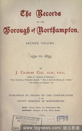
Editorial The records of the borough of Northampton. Preface by the Lord Bishop of London, introductory chapter on the history of the town by W. Ryland D. Adkins. The first volume ed. by Christopher A. Markham. The second volume ed. by the Rev. J. Charles Cox. P...
- 2019-12-18
- 1

Editorial The records of the borough of Northampton. Preface by the Lord Bishop of London, introductory chapter on the history of the town by W. Ryland D. Adkins. The first volume ed. by Christopher A. Markham. The second volume ed. by the Rev. J. Charles Cox. P...
- 2019-11-19
- 1
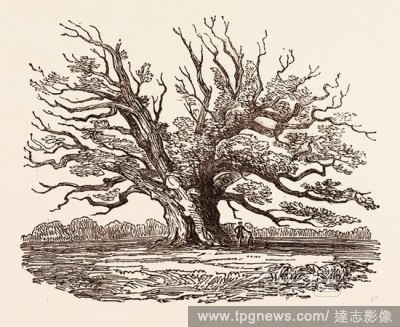
Editorial THE FAIRLOP OAK, IN HAINAULT FOREST in the London Borough of Redbridge, UK, britain, british, europe, united kingdom, great britain, european.
- 2019-11-19
- 1
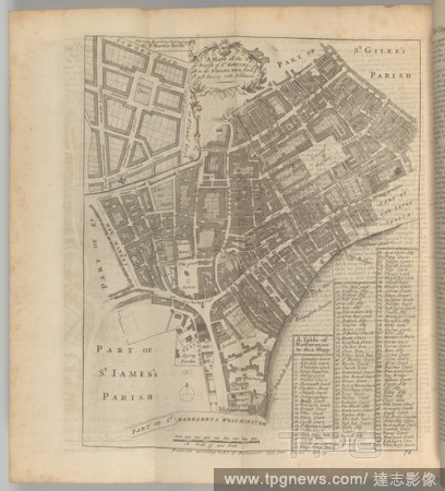
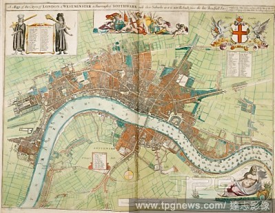
Editorial A survey of the cities of London and Westminster and the Borough of Southwark written at first in the year 1698 (i. e. 1598).. Corrected, improved, and very much enlarged in the year 1720 by John Strype.
- 2019-11-18
- 1

Editorial Rochester Castle, Kent, Plans, Floor Plans of the Rochester Castle Ruin in the Borough of Medway, signed: W. B. Hue Delin, J. Le Keux Sc, Published by Longman & Co, Fig. 54, Pl. I, after p. 158, Hue, W. B. (del.); Keux, John Le (sc.); Longman & Co. (pu...
- 2019-11-18
- 1
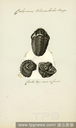
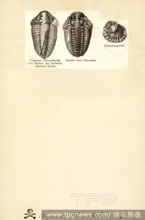
Editorial Calymene blumenbachii, Print, Calymene blumenbachii, sometimes erroneously spelled blumenbachi, is a species of trilobite discovered in the limestone quarries of Wren's Nest Hill in Dudley, England. Nicknamed the Dudley Bug or Dudley Locust by 18th cen...
- 2019-11-18
- 1
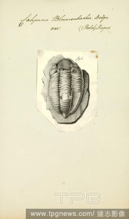
Editorial Calymene blumenbachii, Print, Calymene blumenbachii, sometimes erroneously spelled blumenbachi, is a species of trilobite discovered in the limestone quarries of Wren's Nest Hill in Dudley, England. Nicknamed the Dudley Bug or Dudley Locust by 18th cen...
- 2019-11-18
- 1
Editorial Calymene blumenbachii, Print, Calymene blumenbachii, sometimes erroneously spelled blumenbachi, is a species of trilobite discovered in the limestone quarries of Wren's Nest Hill in Dudley, England. Nicknamed the Dudley Bug or Dudley Locust by 18th cen...
- 2019-11-18
- 1

Editorial The Old Chapel at High Burton. A ruined building destroyed in the 19th century. Sketch. History of the Borough of Preston and its environs, in the county of Lancaster. Preston, Lancaster. 1857, HARDWICK, Charles, of Preston. Source: 10358.f.17 188 (de...
- 2019-07-16
- 1

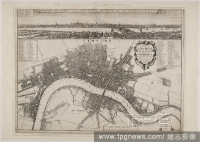
Editorial bird's eye view of New York City with the Hudson River and the New Jersey waterfront on the left, New York Harbor and Governors Island in the right foreground, Battery Park, Manhattan, the East River, Brooklyn Bridge, and the borough of Brooklyn at cen...
- 2019-07-09
- 1
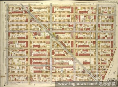
Editorial Brooklyn, Vol. 3, Double Page Plate No. 28; Part of Ward 28, Section 11; Map bounded by Stanhope St., St.Nicholas Ave., Boundary Line Borough of Brooklyn and Queens; Including Palmetto St., Central Ave.
- 2019-07-09
- 1

Editorial Brooklyn, Vol. 4, Double Page Plate No. 10; Part of Ward 26; Sections 12 & 13; Map bounded by Dumont Ave., Warwick St., New Lots Ave., Georgia Ave.; Sub Plan; Map bounded by Boundary Line of the Borough of Brooklyn and Queens, Elderts Lane;.
- 2019-07-09
- 1
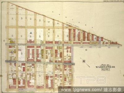
Editorial Brooklyn, Vol. 3, Double Page Plate No. 26; Part of Wards 27 & 28, Section 11; Map bounded by Boundry Line of Borough of Brooklyn and Queens, Ralph St., St.Nicholas Ave.; Including Stanhope St., Irving Ave., Troutman St.
- 2019-07-09
- 1

Editorial Brooklyn, Vol. 3, Double Page Plate No. 30; Part of Ward 28, Section 11; Map bounded by Boundry line of borough of Brooklyn and Queens, Schaeffer St., Kinckerbocker Ave.; Including Palmetto St., Myrtle Ave.; Sub Plan; {map bounded by Schaeffer.
- 2019-07-09
- 1
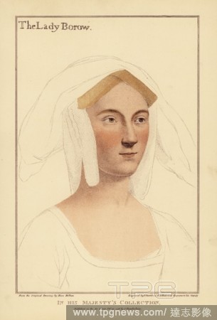
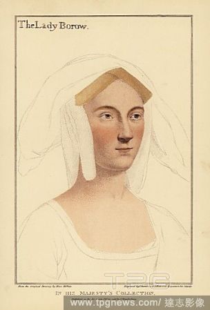
Editorial Catherine Clifton, later Lady Borough (Lady Borow), Wife of William Lord Borough. Second daughter of Edward Clifton, Earl of Lincoln. Recently thought to be Catherine Parr, last wife of KIng Henry VIII. Handcoloured copperplate engraving by Francis Bar...
- 2019-02-22
- 1

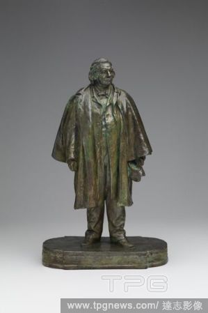
Editorial Henry Ward Beecher.
- 2019-02-01
- 1
Editorial London and Westminster. A Mapp of the Cityes of London & Westminster & Bur. London : J. Seller, [1680]. A map of London, Westminster and the borough of Southwark. Image taken from A Mapp of the Cityes of London & Westminster & Burrough of Southwark wi...
- 2019-01-24
- 1

Editorial The Old Chapel at High Burton. A ruined building destroyed in the 19th century. Sketch. History of the Borough of Preston and its environs, in the county of Lancaster. Preston, Lancaster. 1857, HARDWICK, Charles, of Preston. Source: 10358.f.17 188 (de...
- 2019-01-24
- 1

Editorial London and Westminster. Plan of London and Westminster with the Borough of. London : J. Wyld, 1834. Plan of London and Westminster with the Borough of Southwark. Image taken from Plan of London and Westminster with the Borough of Southwark Scale, 1/2 ...
- 2019-01-24
- 1

Editorial !9th century map of London and Westminster, with the Borough of Southwark. it shows Regents Park and Hyde Park, also Baker Street. Plan of London and Westminster with the Borough of with the Borough of Southwark. London : J. Wyld, 1834. 1/2 a mile[ = 6...
- 2019-01-24
- 1
Editorial London and Westminster. A new and exact Plan of the Cities of London and W. London : Geo. Foster, 1738. A map of A new and exact Plan of the Cities of London and Westminster & the Borough of Southwark. Image taken from A new and exact Plan of the Citi...
- 2019-01-23
- 1

Editorial A map of the cities of London and Westminster and the Borough of Southwark with their suburbs, as it is now rebuilt since the late dreadful fire. A Collection of the County Mapps of the Kingdome of England and Principality of Wales, by John Seller (wit...
- 2018-12-06
- 1
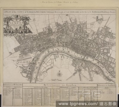
Editorial Plan of the city's of London, Westminster and Borough of Southwark; with the new Additional Buildings; Anno 1720. A New Map of London most humbly inscrib'd to the Rt Worshipfull Sr Peter Delme Kt & Alderm? of London 1720 Revised by Ino Senex S Parke...
- 2018-12-06
- 1
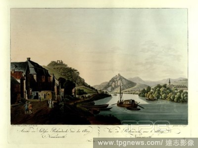
Editorial Figures on a road in the borough of Rolandseck by the Rhine in the foreground, with the ruins of Rolandseck Castle on top of a hill beyond. The town of Honnef on the opposite bank and Franciscan abbey on Nonnenwerth Island in the background. Ansicht de...
- 2018-12-06
- 1
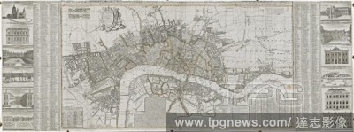
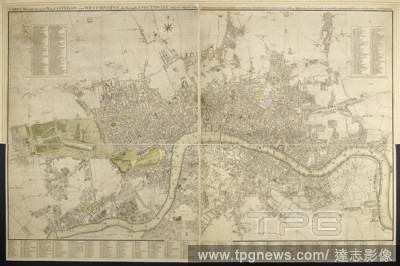
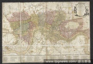
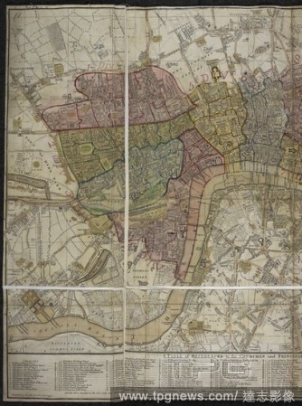
Editorial Map of London and Westminster, the borough of Southwark and parts adjacent. Major streets and open spaces coloured; City of London outlined in red. New developments include the White Lead Manufactory north of the New Road (Marylebone Road) and buildi...
- 2018-12-06
- 1
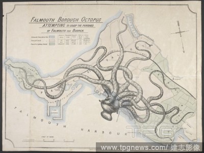
Editorial Falmouth borough octopus attempting to grasp the parishes of Falmouth and Budock. Political map of Falmouth. An octopus is superimposed over a plan of the area, denoting perceived attempts at expansion by Falmouth borough (essentially the town) and the...
- 2018-12-06
- 1
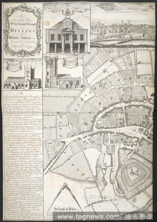
Editorial An accurate Plan of the ancient Borough of Devizes. Source: Maps K.Top.43.33(1). Language: English.
- 2018-12-06
- 1

Editorial London and Westminster. A Mapp of the Cityes of London & Westminster & Bur. London : J. Seller, [1680]. A map of London, Westminster and the borough of Southwark. Image taken from A Mapp of the Cityes of London & Westminster & Burrough of Southwark wi...
- 2018-12-06
- 1
Editorial A plan of the cities of London and Westminster. A new and exact Plan of the Cities of London and Westminster & the Borough of Southwark to this present year, 1738 ... Eman. Bowen Sculp. A scale of 2,640 feet ... [ = 97 mm]. London : Eliz. Foster, 1752....
- 2018-12-06
- 1
Editorial A new and accurate survey of the Cities of London and Westminster. Bowles's new and accurate survey of the Cities of London and Westminster, with the Borough of Southwark, the adjacent country, and extent of the River Thames, from Fulham Bridge to Bow ...
- 2018-12-06
- 1

Editorial The Old Chapel at High Burton. A ruined building destroyed in the 19th century. Sketch. History of the Borough of Preston and its environs, in the county of Lancaster. Preston, Lancaster. 1857, HARDWICK, Charles, of Preston. Source: 10358.f.17 188 (de...
- 2018-12-06
- 1

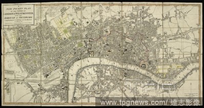
Editorial A map of London. The London Guide, or A Pocket Plan of the Cities of London & Westminster, & Borough of Southwark, with the new buildings, &c. to the year 1767. London : Carington Bowles, [1767]. Source: Maps * 3480.(355.). Language: English.
- 2018-12-06
- 1
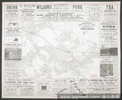
Editorial A street map of Croydon surrounded by advertisements. Business Street Map of Croydon. [Scale, 1 inch = 200 yards]. Leicester : Borough & County Advertising Co., [1895]. Source: Maps 5345.(4.). Language: English.
- 2018-12-06
- 1

Editorial Bowles's New Pocket Plan of London and Westminster with the Borough of Southwark. . Bowles's New Pocket Plan of London and Westminster with the Borough of Southwark, ... from Chelsea to Deptford. [Coloured by hand to show "Divisions of General Postal d...
- 2018-12-06
- 1

Editorial A plan of the cities of London and Westminster. A scale of 26 inches to the mile. A plan of the cities of London and Westminster, the borough of Southwark, and the contiguous buildings: Westminster bridge. 1745. Source: Maps.Crace.3.107. Language: English.
- 2018-12-06
- 1
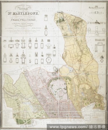
Editorial Topographical survey of the borough of St. Marylebone, as incorporated & defined by Act of Parliament 1832. : Embracing & marking the boundaries of the parishes of St. Marylebone, St. Pancras, & Paddington, also the extents & limits of the principal la...
- 2018-12-06
- 1
Editorial An accurate Plan of the ancient Borough of Devizes. Source: Maps K.Top.43.33(2). Language: English.
- 2018-12-06
- 1
Editorial A plan of London and Westminster. Cary's new and accurate plan of London and Westminster, the borough of Southwark and parts adjacent : viz. Kensington, Chelsea, Islington, Hackney, Walworth, Newington, &c. with an alphabetical list of 500 of the most ...
- 2018-12-06
- 1
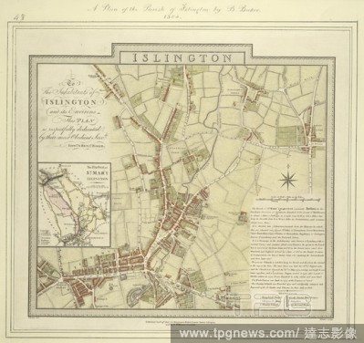
Editorial Map of the borough of Islington with inset plan of the parish of St Mary's on the left of the plate and note giving information about the borough down the right side of the plate. The plan shows the New River, a man made water course supplying London w...
- 2018-12-06
- 1
Editorial London and Westminster. Plan of London and Westminster with the Borough of. London : J. Wyld, 1834. Plan of London and Westminster with the Borough of Southwark. Image taken from Plan of London and Westminster with the Borough of Southwark Scale, 1/2 ...
- 2018-12-06
- 1
Editorial A plan of the cities of London and Westminster; with the borough of Southwark. A new pocket plan of the cities of London & Westminster; with the borough of Southwark, comprehending the new buildings and other alterations to the year 1801. London : Publ...
- 2018-12-06
- 1

Editorial Figures and horses on a street; buildings and shops behind. To the MAYOR and APPROVED MEN of the BOROUGH of GUILDFORD, and the rest of the SUBSCRIBERS to the Erection of the New Public Buildings in that Town, This View of the OLD CORN MARKET and TUNS I...
- 2018-12-06
- 1
Editorial !9th century map of London and Westminster, with the Borough of Southwark. it shows Regents Park and Hyde Park, also Baker Street. Plan of London and Westminster with the Borough of with the Borough of Southwark. London : J. Wyld, 1834. 1/2 a mile[ = 6...
- 2018-12-06
- 1

Editorial A plan of London and Westminster with the Borough of Southwark. Bowles's New Pocket Plan of London and Westminster with the Borough of Southwark, ... from Chelsea to Deptford. [Coloured by hand to show "Divisions of General Postal delivery 1792"]. Lond...
- 2018-12-06
- 1
Editorial A 17th century map of London, covering Westminster and Southwark. A new map of the citties of London Westminster & ye borough of Southwarke, with their suburbs : shewing ye streets, lanes, allies, courts etc. with othe [sic] remarks, as they are now, t...
- 2018-12-06
- 1
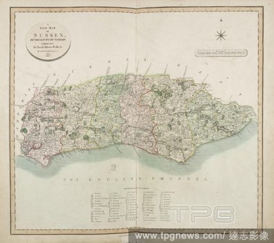
Editorial The New Map of the county of Sussex. Details of roads and rivers, forest and place names containing the cities, market and borough towns, parishes. . Cary’s new English Atlas; being a complete Set of County Maps, from actual Surveys. London, J. Cary,...
- 2018-12-06
- 1

Editorial Figures standing on a street by a classical building with a pediment; shop fronts on either side . To the MAYOR and APPROVED MEN of the BOROUGH of GUILDFORD and the rest of the SUBSCRIBERS to the Erection of these Buildings This View of the FRONT of th...
- 2018-12-06
- 1
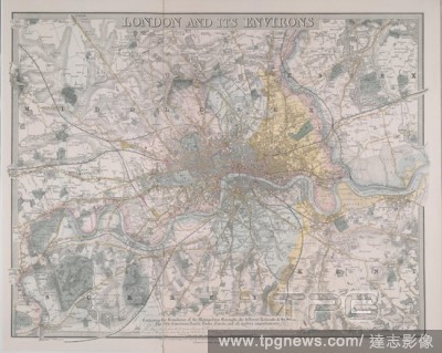
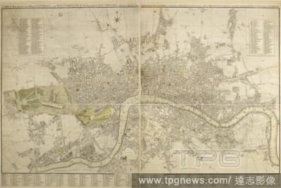
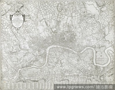
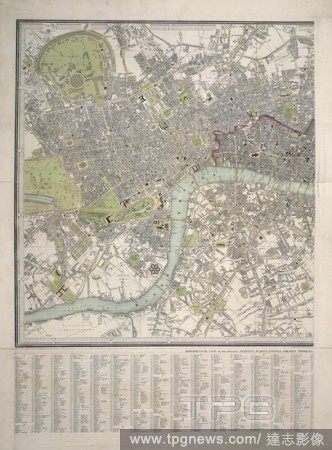
Editorial Coloured map of London covering Essex, Middlesex, and part of Kent and Surrey. London and its environs : containing the boundaries of the metropolitan boroughs, the different railroads & stations, the new cemeteries, roads, docks, canals, and all moder...
- 2018-12-06
- 1
Editorial Bowles's New Pocket Plan of London and Westminster with the Borough of Southwark, ... . Bowles's New Pocket Plan of London and Westminster with the Borough of Southwark, ... from Chelsea to Deptford. [Coloured by hand to show "Divisions of General Post...
- 2018-12-06
- 1

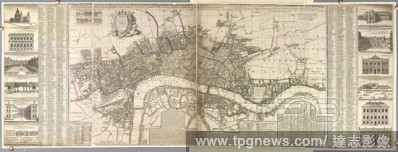
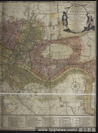
Editorial An 18th century plan of the city of London and Westminster. Plan of the Cities of London and Westminster the Borough of Southwark, and parts adjoining Shewing every house / By R. Horwood. [London] : R. Horwood, 1792-1799. Source: Maps.Crace.Port.5.173 ...
- 2018-12-06
- 1
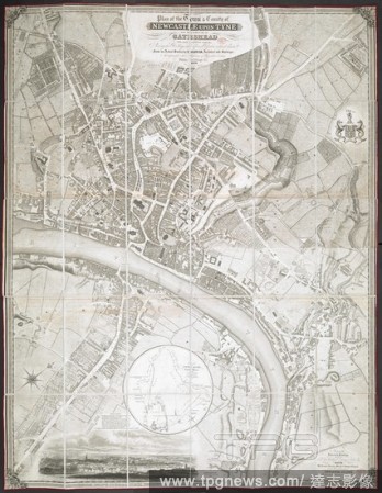
Editorial A plan of Newcastle upon Tyne and the Borough of Gateshead. Plan of the Town and County of Newcastle upon Tyne and the Borough of Gateshead ... from an actual survey by T. Oliver ... 1830. Engraved by W.H. Lizars. Scale, 10 chains[ = 85 mm]. Newcastle ...
- 2018-12-06
- 1

Editorial A wide village street; houses on either side; a tree at the centre of the scene; people standing on the left. BEREALSTON in Devonshire : Under the Tree in the Centre is the place where they elect their Members for the Borough. between 1790-1810. Source...
- 2018-12-06
- 1

Editorial Old Houses in Borough High Street, Southwark. One hundred and twenty plates with text, and fifteen unpublished plates. Society for photographing Relics of Old London. London, 1875. Source: Tab.700.b.3, plate 56.
- 2018-12-06
- 1
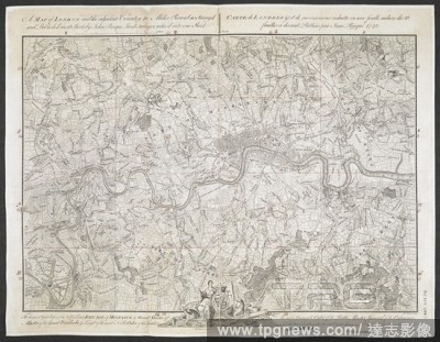
Editorial A map of London and the surrounding area (10 miles). An exact Survey of the City's of London Westminster, ye Borough of Southwark and the country near ten miles round; begun in 1741 and ended in 1745, by J. Rocque; and engrav'd by R. Parr, 1746. Scale ...
- 2018-12-06
- 1
Editorial Bowles's New Pocket Plan of London and Westminster with the Borough of Southwark, ... from Chelsea to Deptford. [Coloured by hand to show "Divisions of General Postal delivery 1792"]. . London, 1792. Source: Maps*3485.(88).
- 2018-12-06
- 1
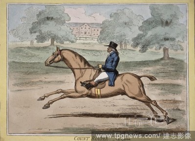
Editorial 'Count Roupee' (Paul Benfield (1741-1810), civil servant and merchant. He went out to India in 1764 as a military engineer in the service of the English East India Company. He resigned his commission to become a private contractor, and built a successf...
- 2018-12-06
- 1
Editorial Bowles's New Pocket Plan of London and Westminster with the Borough of Southwark ... Bowles's New Pocket Plan of London and Westminster with the Borough of Southwark, ... from Chelsea to Deptford. [Coloured by hand to show "Divisions of General Postal ...
- 2018-12-06
- 1
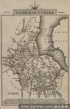
Editorial Map of Somersetshire, showing routes between towns. Placenames. Bristol Channel. . Cary’s Traveller’s Companion, or, a Delineation of the Turnpike Roads of England and Wales. London England. Published by J. Cary, 1790. ; shewing the immediate Route...
- 2018-12-06
- 1

Editorial London and Westminster. A new and exact Plan of the Cities of London and W. London : Geo. Foster, 1738. A map of A new and exact Plan of the Cities of London and Westminster & the Borough of Southwark. Image taken from A new and exact Plan of the Citi...
- 2018-12-06
- 1

Editorial Catherine Clifton, later Lady Borough (Lady Borow), Wife of William Lord Borough. Second daughter of Edward Clifton, Earl of Lincoln. Recently thought to be Catherine Parr, last wife of KIng Henry VIII. Handcoloured copperplate engraving by Francis Bar...
- 2018-10-11
- 1
Editorial Henry Ward Beecher.
- 2018-08-09
- 1

Editorial A survey of the cities of London and Westminster and the Borough of Southwark written at first in the year 1698 (i. e. 1598).. Corrected, improved, and very much enlarged in the year 1720 by John Strype.
- 2018-08-06
- 1
Editorial Catherine Clifton, later Lady Borough (Lady Borow), Wife of William Lord Borough. Second daughter of Edward Clifton, Earl of Lincoln. Recently thought to be Catherine Parr, last wife of KIng Henry VIII. Handcoloured copperplate engraving by Francis Bar...
- 2018-08-02
- 1
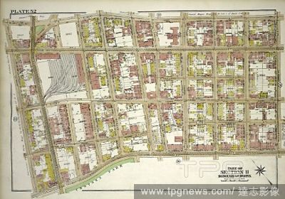
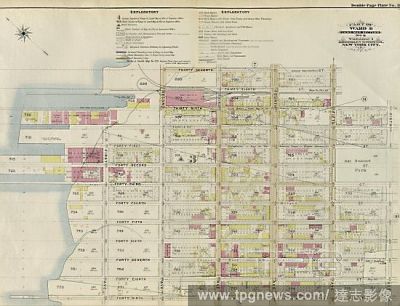
Editorial Plate 52, Part of Section 11, Borough of the Bronx. Bounded by E. 181st Street, Mapes Avenue, E. Tremont Avenue, and Bathgate Avenue.
- 2018-07-31
- 1
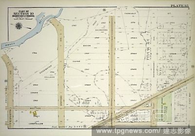
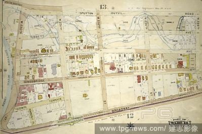
Editorial Plate 35, Part of Section 10, Borough of the Bronx. Bounded by Farragut Street, East Bay Avenue, Longfellow Avenue, and Lafayette Avenue.
- 2018-07-31
- 1

Editorial Plate 33, Part of Section 10, Borough of the Bronx. Bounded by Longfellow Avenue, Ryawa Avenue, Barretto Street, Tiffany Street and East Bay Avenue.
- 2018-07-31
- 1

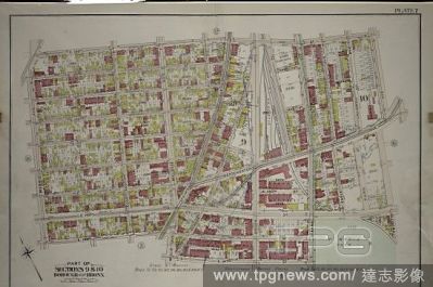
Editorial Plate 2, Part of Sections 9&10, Borough of the Bronx. Bounded by E. 135th Street, Cypress Avenue, E. 132nd Street and Willis Avenue.
- 2018-07-31
- 3
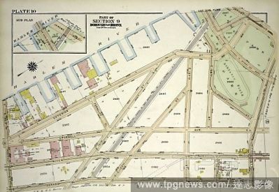
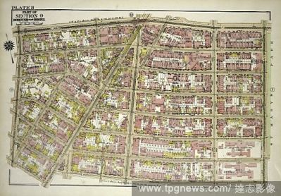
Editorial Plate 10, Part of Section 9, Borough of the Bronx. Bounded by E. Harlem River Piers Exterior Street, Jerome Avenue, E. 161st Street, Gerard Avenue and E. 150th Street.
- 2018-07-31
- 1

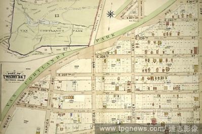
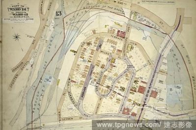
Editorial Plate 74, Part of Section 12, Borough of the Bronx. Bounded by Van Cortlandt Park South, Mosholu Parkway, Sedgwick Avenue, W. 238th Street, Ft. Indepndence Street, W. 236th Street and Broadway.
- 2018-07-31
- 1
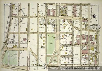
Editorial Atlas of the borough of the Bronx, city of New York : based upon official plans and maps on file in the various city offices; supplemented by careful field measurements and personal observations, by and under the supervision of Hugo Ullitz.
- 2018-07-31
- 1
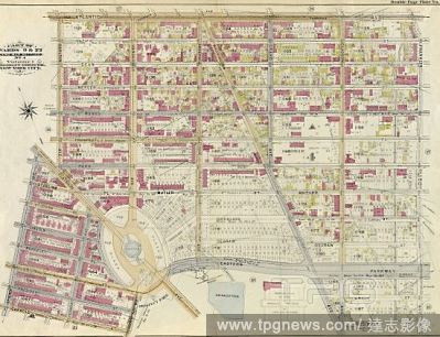
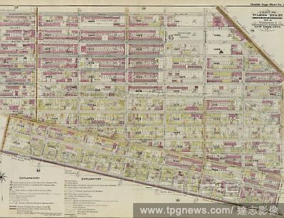
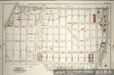
Editorial Part of Wards 9, 22 . Land Map Section, No. 4 , Volume 1, Brooklyn Borough, New York City.
- 2018-07-31
- 2
Editorial Atlas of the borough of the Bronx, city of New York : based upon official plans and maps on file in the various city offices; supplemented by careful field measurements and personal observations, by and under the supervision of Hugo Ullitz.
- 2018-07-31
- 2
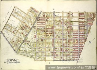
Editorial Queens, Vol. 2, Double Page Plate No. 34; Part of Ward Two East Williamsburgh; Map bounded by Palmetto St., Prospect Ave., Ivy St., Forest Ave., Ptnan Ave., Woodard Ave., Madison St., Myrtle Ave.; Including Boundary Line between borough of Qu.
- 2018-07-31
- 2

Editorial Part of Ward 12. Land Map Section, No. 2, Volume 1, Brooklyn Borough, New York City.
- 2018-07-31
- 1
Editorial Plate 17: Part of Section 10, Borough of the Bronx. Bounded by Coster Street, Edgewater Road, East Bay Avenue, Cabot Street, Leggett Avenue, Garrison Avenue, E. 156th Street, Barry Street, Worthen Street, Truxton Street, Tiffany Street and Spofford Aven.
- 2018-07-31
- 1

Editorial Plate 3: Part of Section 9, Borough of the Bronx. Bounded by E. 149th Street, Morris Avenue, E. 148th Street, Willis Avenue, E. 139th Street, Third Avenue, E. 138th Street, Exterior Street and River Avenue.
- 2018-07-31
- 2
Editorial Atlas of the borough of the Bronx, city of New York : based upon official plans and maps on file in the various city offices; supplemented by careful field measurements and personal observations, by and under the supervision of Hugo Ullitz.
- 2018-07-31
- 6
Editorial Plate 14, Part of Section 9, Borough of the Bronx. Bounded by E. 165th Street, Walton Avenue, E. 166th Street, Morris Avenue, E. 161st Street and Jerome Avenue.
- 2018-07-31
- 2
Editorial Atlas of the borough of the Bronx, city of New York : based upon official plans and maps on file in the various city offices; supplemented by careful field measurements and personal observations, by and under the supervision of Hugo Ullitz.
- 2018-07-31
- 2
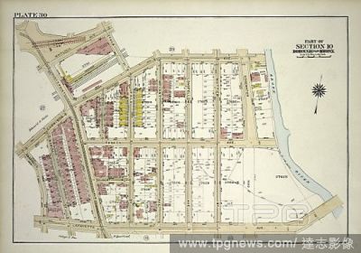
Editorial Plate 30, Part of Section 10, Borough of the Bronx. Bounded by Garrison Avenue, Faile Street, Whitlock Avenue, Huntspoint Avenue, Garrison Avenue, Barretto Street, Lafayette Avenue and Bronx River.
- 2018-07-31
- 3

Editorial Plate 4: Part of Sections 9&10, Borough of the Bronx. Bounded by E. 147th Street, Trinity Avenue, Dater Street, Southern Boulevard, E. 138th Street, Brook Avenue, E. 139th Street and Willis Avenue.
- 2018-07-31
- 1
Editorial Part of Wards 23 & 25. Land Map Section, No. 6, Volume 1, Brooklyn Borough, New York City.
- 2018-07-31
- 1
Editorial Plate 7: Part of Sections 9&10, Borough of the Bronx. Bounded by E. 156th Street, Trinity Avenue, E. 149th Street, St Anns Avenue, E. 147th Street, Willis Avenue, E. 148th Street and Morris Avenue.
- 2018-07-31
- 2
Editorial Part of Ward 8. Land Map Section, No. 3, Volume 1, Brooklyn Borough, New York City.
- 2018-07-31
- 2
Editorial Atlas of the borough of the Bronx, city of New York : based upon official plans and maps on file in the various city offices; supplemented by careful field measurements and personal observations, by and under the supervision of Hugo Ullitz.
- 2018-07-31
- 3

Editorial Part of Ward 29. Land Map Sections, Nos. 15, & 16. Volume 2, Brooklyn Borough, New York City.
- 2018-07-31
- 1
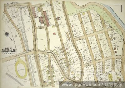
Editorial Plate 72, Part of Section 12, Borough of the Bronx. Bounded by Broadway, W. 230th Street, Reservoir Avenue, W. Kingsbridge Road and Exterior Street.
- 2018-07-31
- 1
Editorial Plate 11: Part of Section 9, Borough of the Bronx. Bounded by Jerome Avenue, E. 169th Street, Park Avenue, E. 164th Street, E. 165th Street and Cromwell Avenue.
- 2018-07-31
- 3

Editorial Part of Wards 29 & 32, Land Map Section, No. 15. Volume 2, Brooklyn Borough, New York City.
- 2018-07-31
- 2
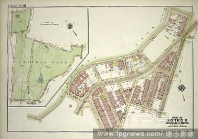
Editorial Plate 48, Part of Section 11, Borough of the Bronx. Bounded by Crotona Park East, Southern Boulevard, E. 172nd Street, Seabury Place, E. 170th Street and Wilkins Avenue.
- 2018-07-31
- 1
Editorial Plate 8, Part of Section 9, Borough of the Bronx. Bounded by E. 149th Street, St. Anns Avenue, E. 142nd Street, Third Avenue, E. 141st Street and Morris Avenue.
- 2018-07-31
- 2

Editorial Part of Wards 18 & 27. Land Map Sections, Nos. 18 & 27. Volume 1, Brooklyn Borough, New York City.
- 2018-07-31
- 1

Editorial Plate 25, Part of Section 10, Borough of the Bronx. Bounded by E. 141st Street, Whitlock Avenue, Leggett Avenue, Cabot Street and East River.
- 2018-07-31
- 2

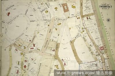
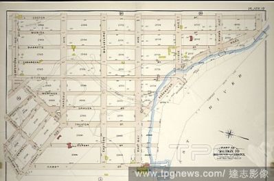
Editorial Part of the Borough of Queens, Jamaica, Ward 4.
- 2018-07-31
- 1

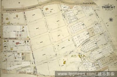
Editorial Plate 15, Part of Section 9, Borough of the Bronx. Bounded by W. 166th Street, Jerome Avenue and Sedgwick Avenue.
- 2018-07-31
- 4
 Loading