
filter
-
Brand
- By Category
- Direction
- Date Range
243Events
Pictures
Events
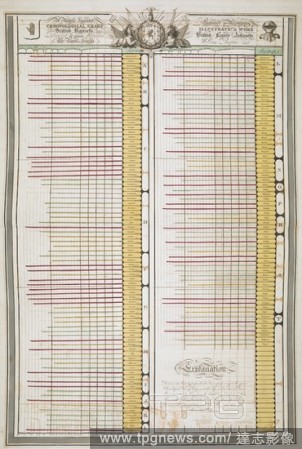
Editorial 'A newly invented chronological chart of Scotish (Scottish) baronets patronised by their Majesties and the Royal family.' . British family antiquity : illustrative of the origin and progress of the rank, honours, and personal merit, of the nobility o...
- 2018-12-06
- 2
Editorial A chart of the Bay of Plenty, New Zealand, from Cape Runaway to Cape Colvill. Made during Captain Cook's First Voyage, after November 1769. Charts and maps illustrating the voyages and surveys of Captain James Cook and other discoverers. 1769-1770. Sou...
- 2018-12-06
- 1
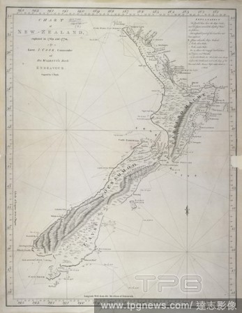
Editorial New Zealand. Chart of New Zealand, explored in 1769 and 1770 by. London, 1772. Source: Maps.*92700.(2),.
- 2018-12-06
- 1
Editorial A chart of the bay of Penzance . Source: Cotton Augustus I.i.35.
- 2018-12-06
- 1
Editorial Chart of Gardiners island and Plum island situated off the coast of America. SIXTY-SEVEN Charts and maps illustrating the voyages and surveys of Capt. James Cook, R.N., and other discoverers; circ. 1760- 1780. c 1760-1780. Source: Add. 31360, no.27.
- 2018-12-06
- 1
Editorial Chart of the Atlantic Ocean, with the western coast of Africa from 27? to 9? north, and the opposite coast of South America from 9? north to 10? south. Jean Rotz, Boke of Idrography (The 'Rotz Atlas'). c 1535-1542. Source: Royal MS 20 E IX f.26. La...
- 2018-12-06
- 1
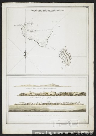
Editorial Chart showing two islands, Amsterdam or Tongataboo, and, Middleburg. Landscape views of Middleburg and Van Diemans, Amsterdam. Tongatapu is the main island of the Kingdom of Tonga. The Resolution stopped here in 1777 under Captain Cook. . SIXTY-SEVEN...
- 2018-12-06
- 1
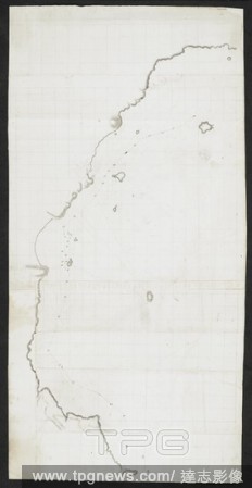
Editorial Chart showing part of the northisland of New Zealand. The two capes are indicated, Cape Teerawhitte and Palliser. SIXTY-SEVEN Charts and maps illustrating the voyages and surveys of Capt. James Cook, R.N., and other discoverers; circ. 1760- 1780. c 176...
- 2018-12-06
- 1

Editorial Calendar chart. North French Miscellany. France, 1278-1298. Source: Add. 11639, f.542v. Language: Hebrew.
- 2018-12-06
- 1

Editorial Chart showing part of South island, New Zealand. Dusky bay is indicated. SIXTY-SEVEN Charts and maps illustrating the voyages and surveys of Capt. James Cook, R.N., and other discoverers; circ. 1760- 1780. c 1760-1780. Source: Add. 31360, no.47.
- 2018-12-06
- 1

Editorial Ordinamento del Paradiso. An astronomical chart. La Materia Divina Commedia ... dichiarata in VI tavole da M. Caetani. Roma, 1855. Source: 1875.b.14 plate VI.
- 2018-12-06
- 1
Editorial Chart of the Indian Ocean, from Cape Comorin on the west to Aimoey Bay in China on the east, and from 25? north to 19? south, including 'Lytil Java.'. Jean Rotz, Boke of Idrography (The 'Rotz Atlas'). c 1535-1542. Source: Royal MS 20 E IX f.10. Langu...
- 2018-12-06
- 1

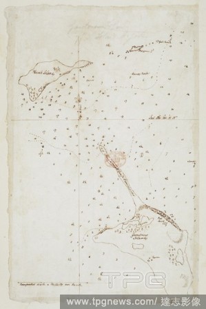
Editorial Chart with notes. SIXTY-SEVEN Charts and maps illustrating the voyages and surveys of Capt. James Cook, R.N., and other discoverers; circ. 1760- 1780. c 1760-1780. Source: Add. 31360, no.12.
- 2018-12-06
- 1
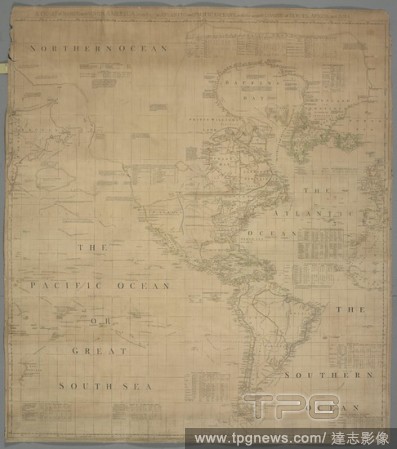
Editorial A chart of North and South America. A CHART of NORTH and SOUTH AMERICA, including the ATLANTIC and PACIFIC OCEANS, with the nearest COASTS of EUROPE, AFRICA, and ASIA. [London] : Publish'd according to Act of Parliament Feb. 19. 1753 by T. Jefferys Geo...
- 2018-12-06
- 1
Editorial Chart of the western coast of Africa from the Gulf of Guinea to the Straits, with the adjacent isles, and a small part of the coast of South America. Jean Rotz, Boke of Idrography (The 'Rotz Atlas'). c 1535-1542. Source: Royal MS 20 E IX f.18. Language...
- 2018-12-06
- 1
Editorial Chart of the eastern coast of America from 51? to 6? north, the West Indies and Gulf of Mexico. Jean Rotz, Boke of Idrography (The 'Rotz Atlas'). c 1535-1542. Source: Royal MS 20 E IX f.23v. Language: French & English.
- 2018-12-06
- 1

Editorial Chart and picture of Savage island. Niue was first seen by Captain James Cook in 1774. He named the island "Savage Island". TWENTY-TWO Charts, views of Headlands, etc., taken during Captain Cook's voyage in the Resolution through the Pacific and South...
- 2018-12-06
- 2
Editorial Chart of South island, New Zealand. SIXTY-SEVEN Charts and maps illustrating the voyages and surveys of Capt. James Cook, R.N., and other discoverers; circ. 1760- 1780. c 1760-1780. Source: Add. 31360, no.51.
- 2018-12-06
- 2
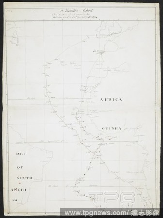
Editorial A Mercator's chart. 'Africa'. 'Guinea.' 'Part of South America.'. SIXTY-SEVEN Charts and maps illustrating the voyages and surveys of Capt. James Cook, R.N., and other discoverers; circ. 1760- 1780. c 1760-1780. Source: Add. 31360, no.2.
- 2018-12-06
- 1

Editorial Long John Silver, Captain Smollett and Jim Hawkins looking at a chart. Treasure Island ... New edition, with original illustrations by Wal Paget. London : Cassell & Co., 1899. Source: 012624.f.3 page 127. Language: English.
- 2018-12-06
- 1
Editorial Chart of the eastern coast of South America from 6? south to the Straits of Magellan. A native enclosure and various activities. Jean Rotz, Boke of Idrography (The 'Rotz Atlas'). c 1535-1542. Source: Royal MS 20 E IX f.28. Language: French & English.
- 2018-12-06
- 1
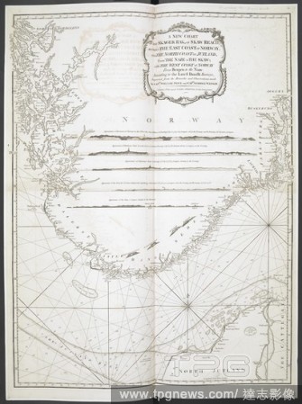
Editorial A new chart of the Skager Rak, or Skaw Reach between the east coast of Norway and the north coast of Jutland . A New Chart of the Skager Rak, or Skaw Reach between the East Coast of Norway and the North Coast of Jutland from the Naze to the Skaw with t...
- 2018-12-06
- 1
Editorial Chart of the eastern coast of South America from 6? south to the Straits of Magellan. Jean Rotz, Boke of Idrography (The 'Rotz Atlas'). c 1535-1542. Source: Royal MS 20 E IX f.27v. Language: French & English.
- 2018-12-06
- 1
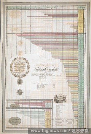
Editorial 'A newly invented chronological chart of British nobility ...'. British family antiquity : illustrative of the origin and progress of the rank, honours, and personal merit, of the nobility of the United Kingdom ; accompanied with an elegant set of chro...
- 2018-12-06
- 1
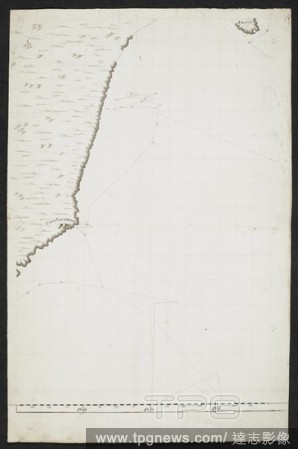
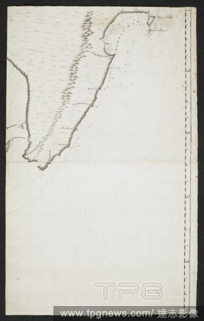
Editorial Chart showing part of the coastline of South island, New Zealand. Cape Saunders is indicated. SIXTY-SEVEN Charts and maps illustrating the voyages and surveys of Capt. James Cook, R.N., and other discoverers; circ. 1760- 1780. c 1760-1780. Source: Add....
- 2018-12-06
- 2
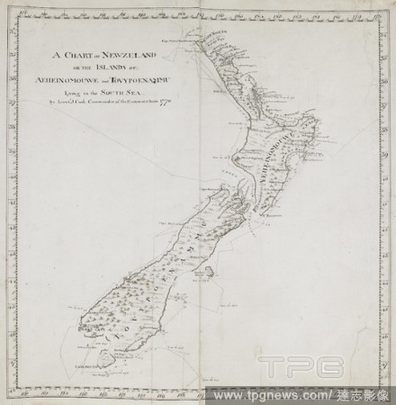
Editorial A general chart of New Zealand; drawn by Lieut. James Cook, shewing his track in 1769-1770. Charts, Plans, Views, and Drawings taken on board the Endeavour during Captain Cook's First Voyage, 1768-1771. 1769-1770. Ms. 1 f. 7 1/2 in. x 1 f. 7 1/2 in.; 5...
- 2018-12-06
- 1

Editorial Chart of the Bay of Plenty, New Zealand, from Cape Colvill to Poverty Bay. Made during Captain Cook's First Voyage, after November 1769. Charts and maps illustrating the voyages and surveys of Captain James Cook and other discoverers. 1769-1770. Source...
- 2018-12-06
- 1
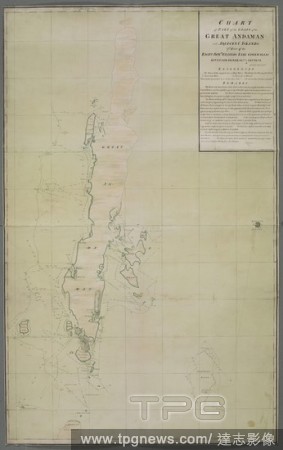
Editorial Chart of part of the coast ... Great Andaman ... islands. SIXTY-SEVEN Charts and maps illustrating the voyages and surveys of Capt. James Cook, R.N., and other discoverers; circ. 1760- 1780. c 1760-1780. Source: Add. 31360, no.30.
- 2018-12-06
- 1
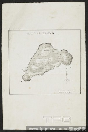
Editorial Chart of Easter island. SIXTY-SEVEN Charts and maps illustrating the voyages and surveys of Capt. James Cook, R.N., and other discoverers; circ. 1760- 1780. c 1760-1780. Source: Add. 31360, no.35.
- 2018-12-06
- 1
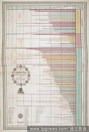
Editorial 'A newly invented chronological chart of British nobility ...'. British family antiquity : illustrative of the origin and progress of the rank, honours, and personal merit, of the nobility of the United Kingdom ; accompanied with an elegant set of chro...
- 2018-12-06
- 1
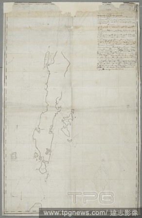
Editorial A manuscript map of Great Andaman Island . CHART of PART of the COAST of the GREAT ANDAMAN and ADJACENT ISLANDS. : Pr: Order of the RIGHT HONble: CHARLES, EARL CORWALLIS, GOVERNOR GENERAL &ca: in COUNCIL. Source: Maps K.Top.116.31.2.TAB. Language: English.
- 2018-12-06
- 1

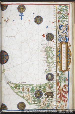
Editorial Chart of the Marquesas (Te Henua) islands. Named on the chart as: Hoods island (Hood's island - ); Le Dominica (Dominica - Hiva Oa); St. Christina, showing Resolution bay (Santa Cristina - Tahuata); St. Pedro (San Pedro - Moho Tani); and, Le Magdalena ...
- 2018-12-06
- 1
Editorial Chart of a coastline and islands. SIXTY-SEVEN Charts and maps illustrating the voyages and surveys of Capt. James Cook, R.N., and other discoverers; circ. 1760- 1780. c 1760-1780. Source: Add. 31360, no.19.
- 2018-12-06
- 1
Editorial General chart of the Black Sea, the Mediterranean, and the coasts of Europe, with the North Sea and the Baltic. Jean Rotz, Boke of Idrography (The 'Rotz Atlas'). c 1535-1542. Source: Royal MS 20 E IX f.19v. Language: French & English.
- 2018-12-06
- 1
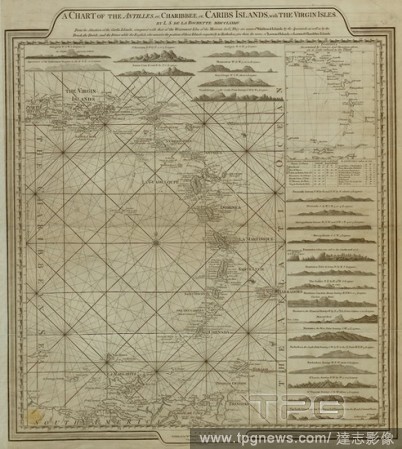
Editorial A chart of the Antilles, or Caribbean Islands, with the Virgin Islands. A Chart of the Antilles or Charibbee, or Caribs Islands; with the Virgin Isles. [London] : Faden, 1784. Source: Maps K.Top.123.68. Language: English.
- 2018-12-06
- 1

Editorial Chart of the coasts of Asia and Africa from Cape Comorin to Cape Delgado, including the Persian Gulf and the Red Sea. Jean Rotz, Boke of Idrography (The 'Rotz Atlas'). c 1535-1542. Source: Royal MS 20 E IX f.12. Language: French & English.
- 2018-12-06
- 1
Editorial Chart of a coastline and islands. SIXTY-SEVEN Charts and maps illustrating the voyages and surveys of Capt. James Cook, R.N., and other discoverers; circ. 1760- 1780. c 1760-1780. Source: Add. 31360, no.22.
- 2018-12-06
- 1
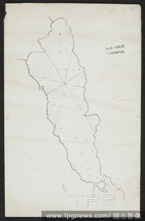
Editorial Chart with the name 'Paradise harbour.'. SIXTY-SEVEN Charts and maps illustrating the voyages and surveys of Capt. James Cook, R.N., and other discoverers; circ. 1760- 1780. c 1760-1780. Source: Add. 31360, no.17.
- 2018-12-06
- 1

Editorial Chart of the eastern coast of America from 51? to 6? north, the West Indies and Gulf of Mexico. Jean Rotz, Boke of Idrography (The 'Rotz Atlas'). c 1535-1542. Source: Royal MS 20 E IX f.24. Language: French & English.
- 2018-12-06
- 1
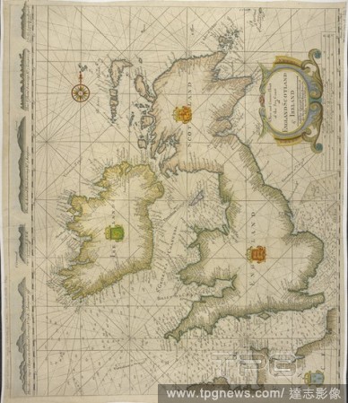
Editorial Correct Chart of the Sea Coast of England Scotland & Ireland, dated 1746. A New and Correct Chart of the Sea Coast of England Scotland & Ireland. James Borlow sculp. Dublin, sold by George Grierson, [1746]. 1746. A copy from the chart by Samuel Thornto...
- 2018-12-06
- 1

Editorial A chart of the coast where a North West Passage was attempted . Chart of the Coast where a North West Passage was attempted ... in the years 1746 & 1747 ... By H. Ellis. J. Mynde fc ... 1794. London : R. Laurie and J. Whittle, 1802. Source: Maps 149.e....
- 2018-12-06
- 1

Editorial A chart of the coasts of South America from Rio de la Plata to Cape Horn, and from Cape Horn to Valparayso. Chart of the Coasts of South America from Rio de la Plata to Cape Horn, and from Cape Horn to Valparayso, etc. (Port St. Julian. Two miles[ = 28...
- 2018-12-06
- 1

Editorial A chart showing letters of the alphabet. The Golden primer. The Golden Primer. [In verse. With illustrations by Walter Crane.]. 2 pt. Blackwood & Sons: London, 1884. Source: 12805.w.33, part.2, p.32.
- 2018-12-06
- 1
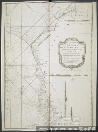
Editorial A new chart of the coast of South and North Jutland, from the Isle of Heilgeland to the Skaw. A New Chart of the Coast of South and North Jutland, from the Isle of Heilgeland to the Skaw. By Captain W. Price and Captain G. Watson. Scale of sea leagues,...
- 2018-12-06
- 1
Editorial "A chart of the Yellow Sea and part of the Continent of China (on Mercator's projection); in the former of which is laid down the tract of the Hindostan and Lion for every day by the chronometer, and the soundings from the streight of Formosa, to the l...
- 2018-12-06
- 1
Editorial Chart of the western coast of Europe, with the opposite coast of North America, from 74? to 29? north. Jean Rotz, Boke of Idrography (The 'Rotz Atlas'). c 1535-1542. Source: Royal MS 20 E IX f.22. Language: French & English.
- 2018-12-06
- 1
Editorial Chart of the Indian Ocean, from Cape Comorin on the west to Aimoey Bay in China on the east, and from 25? north to 19? south, including 'Lytil Java.' [See the extract from Malte-Brun. Jean Rotz, Boke of Idrography (The 'Rotz Atlas'). c 1535-1542. Sou...
- 2018-12-06
- 1
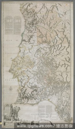
Editorial A map or chart of the Algarve and the Kingdom of Portugal. MAPPA ou CARTA GEOGRAPHICA DOS REINOS DE PORTUGALE ALGARVE. London : [Thomas Jefferys], 1762. Source: Maps K.Top.74.60.2.TAB. Language: Portuguese.
- 2018-12-06
- 1
Editorial Chart of the southern hemisphere shewing the track and discoveries made by the Resolution under the command of Capt. Cook, 1772.3.4& 5. SIXTY-SEVEN Charts and maps illustrating the voyages and surveys of Capt. James Cook, R.N., and other discoverers; c...
- 2018-12-06
- 1
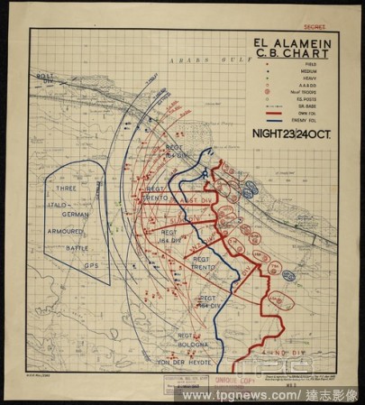
Editorial A chart with the title El Alamein C.B. showing the positions of British army forces and an area indicated as 'three Italo German armoured battle gps.'. El Alamein C. B. chart, Night 23/24 Oct. [1942], MDR Misc 2245. [Cairo] : [Survey Directorate, Middl...
- 2018-12-06
- 2

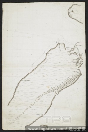
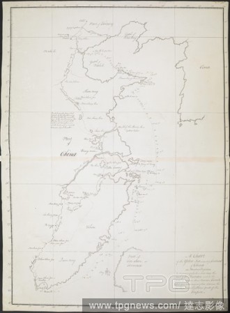
Editorial The Middle and North lslands of New Zealand, by James Cook; 1770. A chart of part of New Zealand or the island of Aeheinomouwe lying in the south sea by Lieutenant J.Cook commander of his Majesty's Bark the Endeavour. CHARTS and maps made during voyage...
- 2018-12-06
- 1

Editorial Chart of the western coast of Africa from the Gulf of Guinea to the Straits, with the adjacent isles, and a small part of the coast of South America. Jean Rotz, Boke of Idrography (The 'Rotz Atlas'). c 1535-1542. Source: Royal MS 20 E IX f.17v. Languag...
- 2018-12-06
- 1
Editorial Chart of the western coast of Europe, with the opposite coast of North America, from 74? to 29? north. Jean Rotz, Boke of Idrography (The 'Rotz Atlas'). c 1535-1542. Source: Royal MS 20 E IX f.21v. Language: French & English.
- 2018-12-06
- 1
Editorial Chart of the Gulf of Mexico and the Pacific Ocean, from 34? north to 11? south. Jean Rotz, Boke of Idrography (The 'Rotz Atlas'). c 1535-1542. Source: Royal MS 20 E IX f.7v. Language: French & English.
- 2018-12-06
- 2
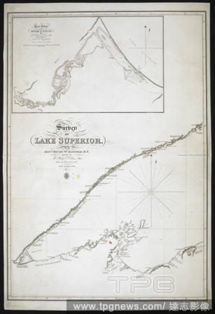
Editorial A survey of Lake Superior. A Track Survey of the River Saint Louis. Survey of Lake Superior. Track Survey of the River Saint Louis, etc. [Admiralty Chart]. 1828. Source: Maps SEC.7.(320.). Language: English.
- 2018-12-06
- 2

Editorial Chart of the progress od the Asiatic cholera in Exeter from the 19th of July to the 12th of Sept. 1832; showing the number of cases, deaths and recoveries. The History of the Cholera in Exeter in 1832. London : J. Churchill, 1849. Source: 7650.d.59 pag...
- 2018-12-06
- 1
Editorial A chart. An account of a Voyage for the Discovery of a Nort. Jolliffe: London, 1748, 1749. Source: 978.k.27, opposite 288. Language: English.
- 2018-12-06
- 1

Editorial A chart of a coastl area. A treatise on Marine Surveying. ... Corrected ... London, 1774. Source: 60.d.6, plate 2. Language: English.
- 2018-12-06
- 1
Editorial A nautical chart of the Straits of Gibraltar . Carta esfe?rica del estrecho de Gibraltar ... Construida por V. Tofin?o de San Miguel. [Madrid], 1786. Source: Maps * 18440.(11.).
- 2018-12-06
- 1

Editorial Chart of South Africa from 15? south on the east coast to 6? north on the west coast. Jean Rotz, Boke of Idrography (The 'Rotz Atlas'). c 1535-1542. Source: Royal MS 20 E IX f.16. Language: French & English.
- 2018-12-06
- 1
Editorial General chart of the Black Sea, the Mediterranean, and the coasts of Europe, with the North Sea and the Baltic. Jean Rotz, Boke of Idrography (The 'Rotz Atlas'). c 1535-1542. Source: Royal MS 20 E IX f.20. Language: French & English.
- 2018-12-06
- 2

Editorial A chart of the New Zeland (Zealand) or the islands ... of the south sea. A chart of the New Zeland or the islands ... of the south sea by Lieu. J. Cook, commander of his Majestys Bark the Endeavour ... 1769 - 1770. Source: Sloane 7085.b.
- 2018-12-06
- 1
Editorial Chart of the eastern coast of Africa. Jean Rotz, Boke of Idrography (The 'Rotz Atlas'). c 1535-1542. Source: Royal MS 20 E IX f.14. Language: French & English.
- 2018-12-06
- 1
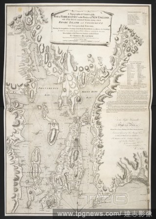
Editorial A topographical chart of the Bay of Narraganset . A Topographical CHART of the BAY of NARRAGANSET in the Province of NEW ENGLAND, with all the ISLES contained therein, among which RHODE ISLAND and CONNONICUT have been particularly SURVEYED. : Shewing t...
- 2018-12-06
- 2

Editorial A charts illustrated with sketches of lighthouses along the coasts of Norway and Sweden. . Lighthouse recognition chart, Series GSGS 4481. [London] : War Office, 1944. Second edition. Source: Maps MOD GSGS 4481 Sheet 2, Norway south.
- 2018-12-06
- 1
Editorial A chart showing four islands. SIXTY-SEVEN Charts and maps illustrating the voyages and surveys of Capt. James Cook, R.N., and other discoverers; circ. 1760- 1780. c 1760-1780. Source: Add. 31360, no.37.
- 2018-12-06
- 1
Editorial Topographical features. [A Chart of Nantucket Island... 1776. Various topographical features. Image taken from: [A Chart of Nantucket Island and part of Martha's Vineyard]. Published in 1776 . Source: Maps.184.m.3.(37). Language: English.
- 2018-12-06
- 1
Editorial Wexford Harbour. A colored chart of the harbours of Waterford and W. 1776. Wexford Harbour and Greenore Bay. Image taken from A colored chart of the harbours of Waterford and Wexford, with the coast adjacent; drawn in 1776, by Lieut.-Col. Charles Vall...
- 2018-12-06
- 1

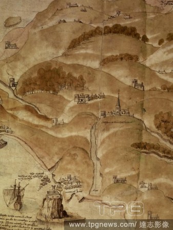
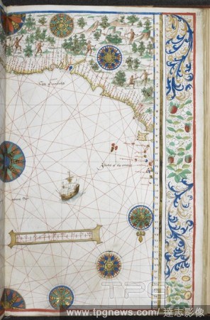
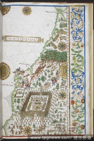
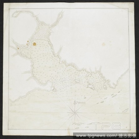
Editorial Map of Mount's Bay in Cornwall. Coastline. Sand flats and sheltered estuary and bay. Ships. . A Large colored chart of Mount’s Bay, in Cornwall. Cornwall, drawn c. 1540. A Large colored chart of Mount’s Bay, in Cornwall, drawn c. 1540. . Source: Co...
- 2018-12-06
- 1

Editorial A Tudor rose symbol. . Codex et membran. et chart. Source: Cotton Titus D. IV f.11v.
- 2018-12-06
- 1
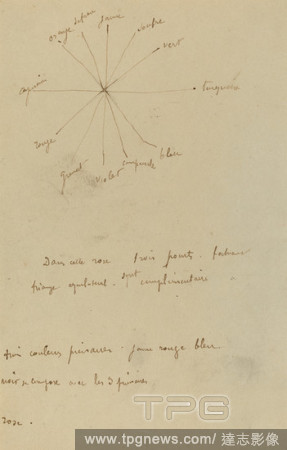
Editorial Color Chart with Annotations [verso]. Dated: 1884-1888. Dimensions: overall: 16.9 x 13.2 cm (6 5/8 x 5 3/16 in.). Medium: pen and brown ink on wove paper.
- 2018-11-21
- 1
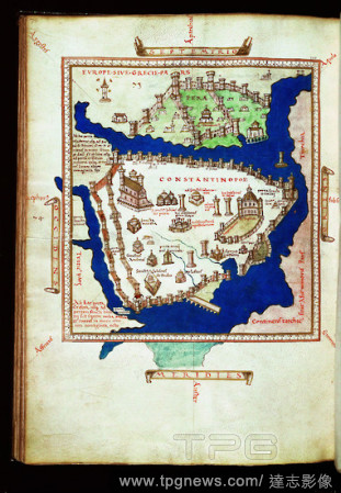
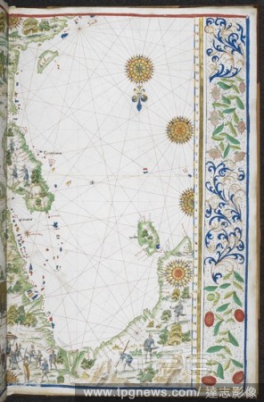
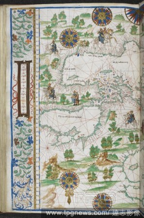
Editorial Mariner's chart of America, Europe, Africa and Asia: Detail: map of Constantinople, French,16th.
- 2018-10-11
- 1

Editorial Chart of Coverlet Thread Construction. Dated: 1941. Dimensions: overall: 35.7 x 26.7 cm (14 1/16 x 10 1/2 in.). Medium: watercolor, graphite, and pen and ink on paper.
- 2018-09-25
- 1

Editorial Color Chart with Annotations [verso]. Dated: 1884-1888. Dimensions: overall: 16.9 x 13.2 cm (6 5/8 x 5 3/16 in.). Medium: pen and brown ink on wove paper.
- 2018-09-18
- 1
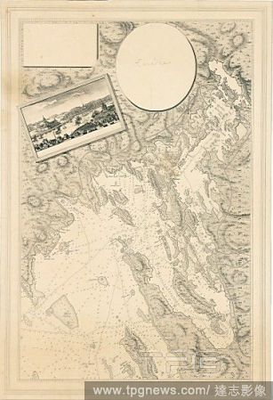
Editorial Sea chart of Vyborg bay, Russia.
- 2018-08-09
- 1

Editorial Ewer.
- 2018-08-09
- 1

Editorial Nebuleuse de la Lyre.
- 2018-08-08
- 1

Editorial Vase (one of a pair).
- 2018-08-08
- 1

Editorial Vase (one of a pair).
- 2018-08-08
- 1

Editorial Pocket Qur'an.
- 2018-08-06
- 1

Editorial Teapot with cover.
- 2018-08-06
- 1

Editorial A Section of the Constellation Cygnus (August 13, 1885).
- 2018-08-06
- 1

Editorial Sampler listing the counties of England.
- 2018-08-06
- 1

Editorial Vase (one of a pair).
- 2018-08-06
- 1

Editorial CUP.
- 2018-08-06
- 1

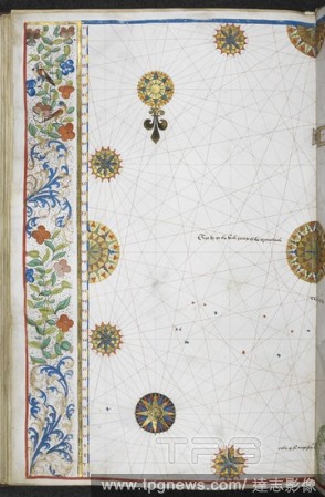
Editorial Chart of the Signs of the Zodiac with Venus, Cupid, and a Bishop Saint.
- 2018-08-06
- 1

Editorial 1910, U.S. Coast Survey Nautical Chart or Map of New York City and Harbor.
- 2018-08-06
- 1
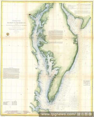
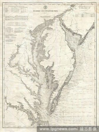
Editorial 1855, U.S. Coast Survey Chart or Map of Chesapeake Bay and Delaware Bay.
- 2018-08-06
- 1
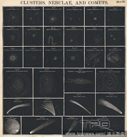
Editorial 1856, Burritt, Huntington Chart of Comets, Star Clusters, Galaxies, and Nebulae.
- 2018-08-06
- 1

Editorial 1868, British Admiralty Chart or Map of the Mediterranean Sea, Italy, Corsica, Greece, Tunisia.
- 2018-08-06
- 1
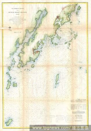
Editorial 1864, U.S. Coast Survey Map or Chart of St. Georges River and Muscle Ridge Channel, Maine.
- 2018-08-06
- 1

Editorial 1831, Depot de la Marine Nautical Chart or Map of Martinique, West Indies.
- 2018-08-06
- 1
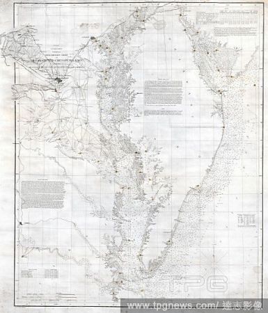
Editorial 1893, U.S. Coast Survey Nautical Chart or Map of the Chesapeake Bay and Delaware Bay.
- 2018-08-06
- 1

Editorial 1859, U.S. Coast Survey Chart or Map of Hempstead Harbor, Long Island, New York.
- 2018-08-06
- 1
Editorial 1855, U.S. Coast Survey Nautical Chart or Map of the Chesapeake Bay.
- 2018-08-06
- 1
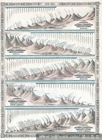
Editorial 1864, Johnson's World Mountains and Rivers Map or Chart.
- 2018-08-06
- 1
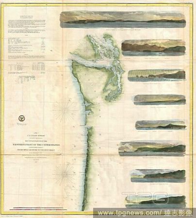
Editorial 1855, U.S. Coast Survey Chart or Map of Washington and Oregon.
- 2018-08-06
- 1
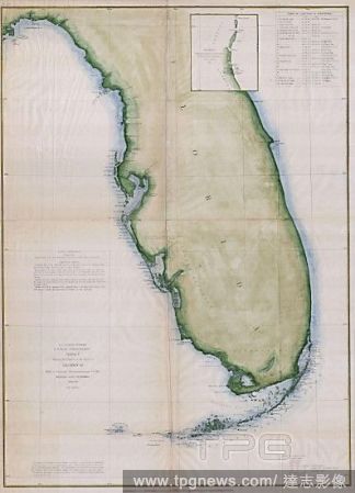
Editorial 1853, U.S.C.S. Map or Chart of Florida.
- 2018-08-06
- 1

Editorial 1865, U.S.C.S. Chart or Map of the Mississippi River around Cairo Illinois.
- 2018-08-06
- 2

Editorial 1857, U.S. Coast Survey Map or Chart of the Rappahannock River, Virginia.
- 2018-08-06
- 1
 Loading