
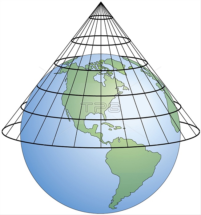
A conical projection is obtained by projecting the surface of Earth onto a cone that is in contact with a parallel. On the resulting fan-shaped map, distortions become greater on either side of the contact zone. This projection system, which can portray only part of the planet, is frequently used to produce maps of regions in the middle latitudes.
| px | px | dpi | = | cm | x | cm | = | MB |
Details
Creative#:
TOP19705865
Source:
達志影像
Authorization Type:
RM
Release Information:
須由TPG 完整授權
Model Release:
No
Property Release:
No
Right to Privacy:
No
Same folder images:
 Loading