
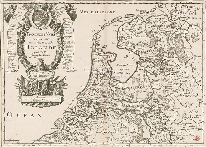
Map of the Republic of the Seven United Netherlands, Provinces Unies des Pais-Bas connues sous le nom de Holande (title on object), French map of the Republic. Top left cartouche with title, above it the coat of arms of Stadholder William III. Below title a female figure bearing a cartouche with place of publication, publisher and privilege. Beneath cartouche: Quinze lieues de France chacune de 3000 pas geometriques. Left and right of cartouche a putto with a banderole on which the Dutch overseas possessions in the West and East respectively are mentioned. Degree divisions along edges. print maker: N. Michu, (mentioned on object), print maker: Pierre Brissart, (mentioned on object), Pierre Duval, (mentioned on object), Paris, 1679, paper, engraving, etching, height 394 mm x width 547 mm.
| px | px | dpi | = | cm | x | cm | = | MB |
Details
Creative#:
TOP28937961
Source:
達志影像
Authorization Type:
RM
Release Information:
須由TPG 完整授權
Model Release:
No
Property Release:
No
Right to Privacy:
No
Same folder images:
 Loading