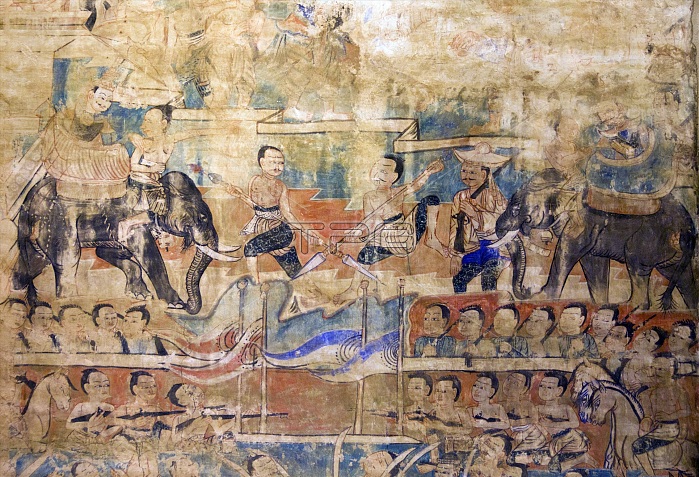
Wat Pa Daet (?????????), the name ˉsunlit woodlandˇ indicates this was formerly a forest temple. A walled enclosure contains a viharn, sala and ho trai or library, while just outside stands an ubosot in traditional northern style, surrounded by a narrow moat. The viharn dates from 1877 and was painstakingly restored in the mid-1980s. Decorated in black and gold, the three-tiered roof sweeps low in typical Lan Na style, with elaborate winged gables supporting flaring naga. The steps leading to the portico are guarded by Burmese-style chinthe lions and naga-makara balustrades, with the chinthe emerging from the makara mouths, an unusual synthesis found elsewhere in the Mae Chaem Valley as well as at the ho trai of Wat Phra Singh in Chiang Mai. Within the viharn, after passing beneath gilded eyebrow pelmets, are a series of relatively well-preserved late 19th century murals, some of which appear to have been restored, while others are fading almost completely away due perhaps to salinity in the plaster. Of particular interest are panels showing northern Thai women with their long tresses, quite different to Bangkok fashions of the time, and a Buddha birth-scene, northern Thai style, with women crowding around Gautamaˇs mother as she gives birth standing upright, holding on to the branches of a tree. Tucked away in a narrow valley, Mae Chaem (???????) must rank as one of the least accessible corners of Chiang Mai. Located on the westernmost frontier of the province, it is isolated from the main Chiang Mai valley by the East Thanon Thongchai Range dominated by Doi Inthanon (???????????; at 2,565m Thailandˇs highest mountain), and from neighbouring Mae Hong Son province to the west by the Central Thanon Thongchai Range, including Doi Khun Bong (????????; 1,772m).
| px | px | dpi | = | cm | x | cm | = | MB |
Details
Creative#:
TOP27330353
Source:
達志影像
Authorization Type:
RM
Release Information:
須由TPG 完整授權
Model Release:
No
Property Release:
No
Right to Privacy:
No
Same folder images:

 Loading