
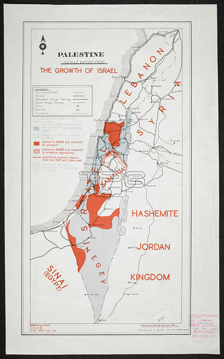
A map showing: Israel; Lebanon; Samaria; Sinai (Egypt); Syria; Hashemite Jordan Kingdom. ; Overprinted by 42 Svy Enr Reg June 1949. maps: col.; Scale 1: 1 000 000.[Cairo]: [Survey Directorate; Middle East]; 1948. Produced by: British army: Royal Engineers. Survey Engineers Regiment; 42nd.From: The growth of Israel; MDR Misc. 11345.Maps MOD MDR MISC 11345London; British Library.
| px | px | dpi | = | cm | x | cm | = | MB |
Details
Creative#:
TOP21008563
Source:
達志影像
Authorization Type:
RM
Release Information:
須由TPG 完整授權
Model Release:
No
Property Release:
No
Right to Privacy:
No
Same folder images:
Restriction:
Additional permissions needed for non-editorial use.
 Loading