
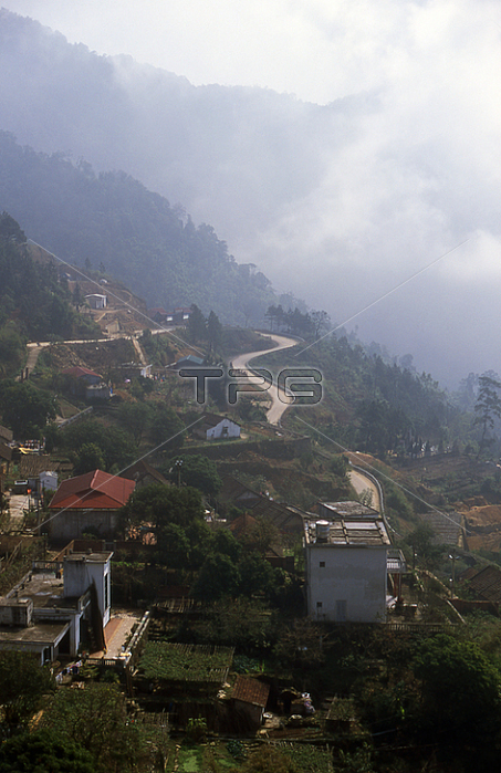
The French developed Tam Dao as a hill station in 1907; intending it as a popular retreat from the baking plains of the Red River summer; but closer to and more accessible from Hanoi than Sapa; further to the north on the Chinese frontier.
The name 鈥楾am Dao' derives from the 鈥楾hree Islands'; which are in fact a line of three peaks; all around 1;400 metres (4;593 ft) in height; which can sometimes; but far from always; be seen rising above the surrounding clouds; like islands in a sea of mist. After the French left; in 1954; the resort fell on hard times; but has since been rediscovered. It appeals mainly to people from Hanoi; especially nature lovers who come at weekends to visit Tam Dao National Parkl.
Tam Dao was not always thus. When the French began their conquest of Tonkin in the last quarter of the 19th century; large parts of the north refused to submit. In particular an area around Yen The; some 40 km (25 miles) east of Tam Dao; became famous for the resistance offered by a local chieftain; Hoang Hoa Tham; better known as De Tham; and popularly celebrated as the 鈥楾iger of Yen The'.
| px | px | dpi | = | cm | x | cm | = | MB |
Details
Creative#:
TOP20139140
Source:
達志影像
Authorization Type:
RM
Release Information:
須由TPG 完整授權
Model Release:
No
Property Release:
No
Right to Privacy:
No
Same folder images:
 Loading