
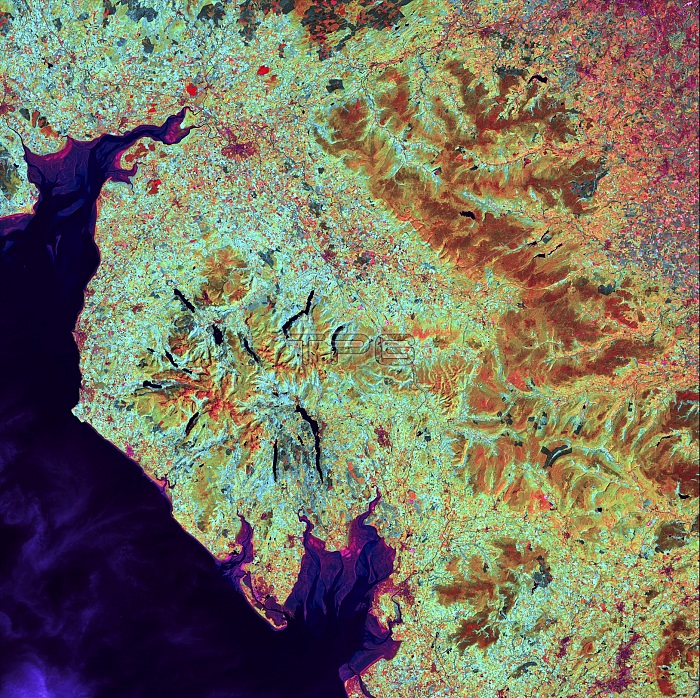
Lake District, satellite image. This region in Cumbria in north-western England consists of a landscape of mountains and long, narrow lakes. Most of the lakes lie in U-shaped valleys that were carved by glaciers during the last ice age. Morecambe Bay, at lower centre below the Lake District, opens into the Irish Sea. This large expanse of intertidal sand and mudflats is notorious for its quicksand and fast-moving tides. Image data obtained by the Landsat 5 satellite on 19 July 2006.
| px | px | dpi | = | cm | x | cm | = | MB |
Details
Creative#:
TOP19653134
Source:
達志影像
Authorization Type:
RM
Release Information:
須由TPG 完整授權
Model Release:
N/A
Property Release:
N/A
Right to Privacy:
No
Same folder images:
 Loading