
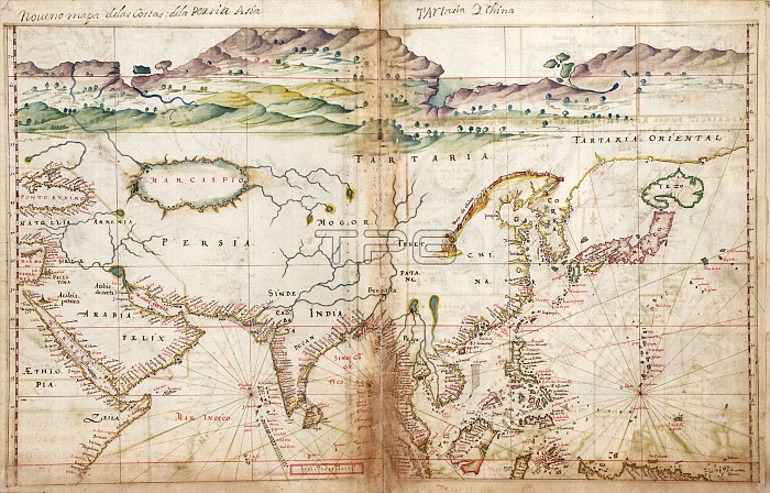
Asia. 17th-century map of Asia and the new lands being discovered by European explorers in the Far East. The title (top) names Persia, Asia, Tartaria (Tartary) and China. Places shown include Ethiopia, Saudi Arabia, Anatolia (Turkey), Armenia, the Black Sea, the Caspian Sea, Persia, India, regions of Central Asia, Tibet, China, Korea, Japan, Borneo, the Philippines, and some of the islands of the Western Pacific. This map is from 'Taboas geraes de toda a navegacao' (1630), an atlas produced by Portuguese cartographer Joao Teixeira Albernaz I (active 1602-1648). Albernaz was the most prolific Portuguese cartographer of the seventeenth century.
| px | px | dpi | = | cm | x | cm | = | MB |
Details
Creative#:
TOP16235312
Source:
達志影像
Authorization Type:
RM
Release Information:
須由TPG 完整授權
Model Release:
N/A
Property Release:
N/A
Right to Privacy:
No
Same folder images:
 Loading