
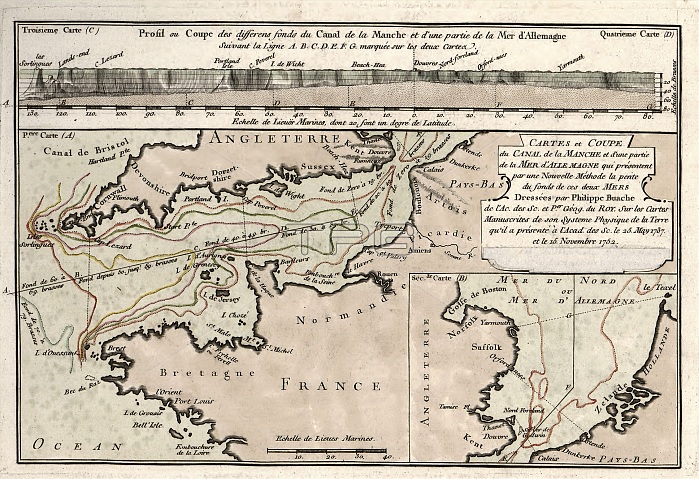
Map of the English Channel. 18th-century map showing the varying depths found in the English Channel ('La Manche') separating France and England. The labels and inscription are in French. This map is from 'Cartes et tables de la geographie physique ou naturelle' (1757) by French geographers and cartographers Philippe Buache (1700-1773) and Guillaume de l'Isle (1675-1726).
| px | px | dpi | = | cm | x | cm | = | MB |
Details
Creative#:
TOP16028992
Source:
達志影像
Authorization Type:
RM
Release Information:
須由TPG 完整授權
Model Release:
N/A
Property Release:
N/A
Right to Privacy:
No
Same folder images:
1700s175718thcenturyartworkcartesettablesdelageographiephysiqueounaturellecartographychannelenglandenglishchannelfrenchfrenchlanguagegeographicalgeographyguillaumedel'isleguillaumedelislehistoricalhistoryillustrationlamanchelabellabeledlabelledlabelsmapno-onenobodyoceanographyphilippebuachephysicalgeograhytext
1700s175718thartworkbuachecartescartographycenturychannelchanneldededelisleenglandenglishetfrenchfrenchgeograhygeographicalgeographiegeographyguillaumeguillaumehistoricalhistoryillustrationl'islelalalabellabeledlabelledlabelslanguagemanchemapnaturelleno-onenobodyoceanographyouphilippephysicalphysiquetablestext
 Loading