
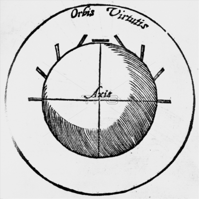
Earth's magnetic field. Engraving of the dip of the Earth's magnetic field at various latitudes drawn by William Gilbert (1544-1603). The north- south axis is horizontal. The orientations of the magnetic field lines at various points are shown by the thick lines in the upper frame. The space in which the magnetic dip is detectable was called the Orbis Virtutis by Gilbert. He obtained his data using a spherical lodestone (terella) & short pieces of iron wire. The observed phenomena at different lattitudes on Earth are the same. Gilb- ert was the first person to consider the Earth as a vast spherical magnet. Image taken from Gilbert's De Magnete of 1600.
| px | px | dpi | = | cm | x | cm | = | MB |
Details
Creative#:
TOP10242100
Source:
達志影像
Authorization Type:
RM
Release Information:
須由TPG 完整授權
Model Release:
N/A
Property Release:
N/A
Right to Privacy:
No
Same folder images:
 Loading