
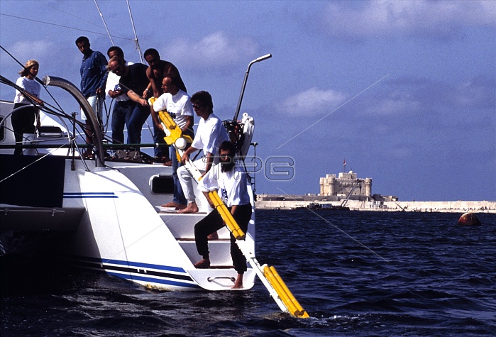
Underwater archaeology. Archaeologists with a magnetometer used to map underwater ruins. This was part of a project led by the French marine archaeologist Franck Goddio, which mapped the Royal Quarter of the ancient city of Alexandria, Egypt. The area is now submerged in the modern city's Eastern Harbour.
| px | px | dpi | = | cm | x | cm | = | MB |
Details
Creative#:
TOP10233255
Source:
達志影像
Authorization Type:
RM
Release Information:
須由TPG 完整授權
Model Release:
N/A
Property Release:
N/A
Right to Privacy:
No
Same folder images:
 Loading