
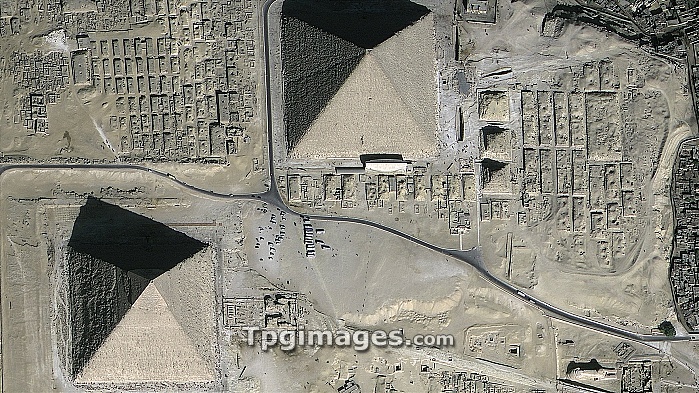
Pyramids of Giza, Egypt, GeoEye satellite image. North is at top. These monuments were built between 2600 and 2500 BC, as tombs for the pharaohs of Ancient Egypt. Up to 230 metres across and 140 metres in height, they were the tallest structures in the world when built. The Great Pyramid (upper right), was built for Pharaoh Cheops (or Khufu). Khafre's Pyramid is at lower left. The third, Menkaure's Pyramid, is not seen. The Sphinx is at bottom right, and small satellite pyramids are also seen. Tourist coaches are at centre. GeoEye is a US-based company that provides the world's highest resolution commercial satellite images.
| px | px | dpi | = | cm | x | cm | = | MB |
Details
Creative#:
TOP06673388
Source:
達志影像
Authorization Type:
RM
Release Information:
須由TPG 完整授權
Model Release:
NO
Property Release:
NO
Right to Privacy:
No
Same folder images:
 Loading