
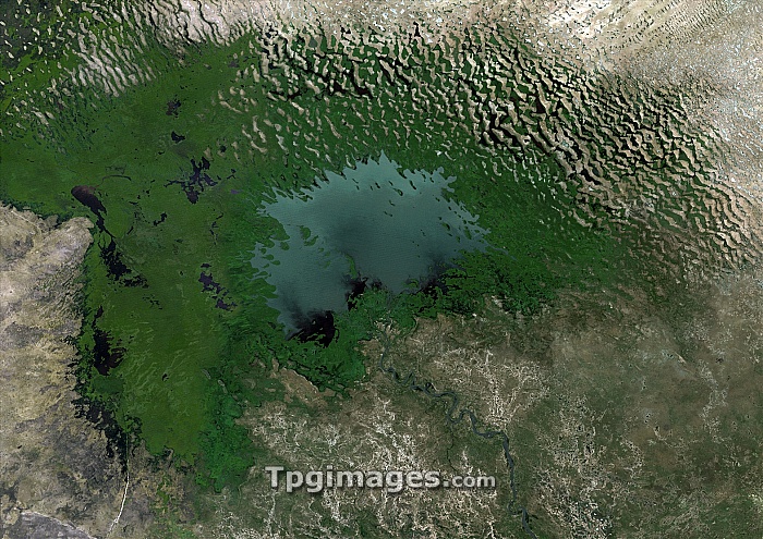
Lake Chad, 1975. Landsat satellite image of Lake Chad (centre) located in the Sahel region, just south of the Sahara. In the 1960s this was the fourth largest lake in Africa with an area of more than 26,000 square kilometres. Since then Lake Chad has shrunk dramatically, covering only 1,500 square kilometres in 2000. The loss of area is due to increased use for irrigation, droughts and overgrazing in the area. Vegetation (green) covers some of the old lake bed.
| px | px | dpi | = | cm | x | cm | = | MB |
Details
Creative#:
TOP06670146
Source:
達志影像
Authorization Type:
RM
Release Information:
須由TPG 完整授權
Model Release:
NO
Property Release:
NO
Right to Privacy:
No
Same folder images:
 Loading