
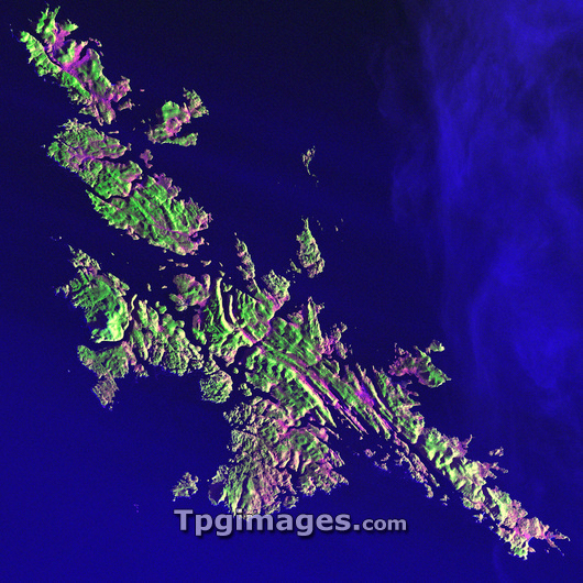
Shetland Islands, satellite image. North is at upper left. Vegetation varies from pink to green, depending on its moisture content. The landscape is a rugged terrain of hills covered in grass and heather. The Shetland Islands lie 210 kilometres north of the Scottish mainland, in the North Atlantic Ocean. Despite their 60 degrees North latitude, the Shetlands enjoy a relatively temperate climate thanks to the warming influence of the Gulf Stream. Akpatok Island, at roughly the same latitude, is encased in ice at this time of year (see image E205/131). The area shown in this image is around 90 kilometres wide. The image data includes infrared wavelengths, and was obtained on 11 December 2001, by the Landsat 7 satellite.
| px | px | dpi | = | cm | x | cm | = | MB |
Details
Creative#:
TOP03208828
Source:
達志影像
Authorization Type:
RM
Release Information:
須由TPG 完整授權
Model Release:
N/A
Property Release:
N/A
Right to Privacy:
No
Same folder images:
 Loading