
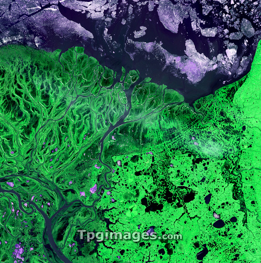
Yukon Delta, satellite image. North is at upper left. Vegetation is green, water is dark blue, and ice is pink/white. The Yukon Delta has formed from sediments deposited by the Yukon and Kuskokwim rivers as they flow into the Bering Sea on the western coast of Alaska, USA. The delta supports a wide variety of wildlife on shore and offshore, where sheets of sea ice form during the coldest months of the year. The area shown in this image is around 60 kilometres wide. The image data includes infrared wavelengths, and was obtained on 26 May 2002, using the ASTER sensor on the Terra satellite.
| px | px | dpi | = | cm | x | cm | = | MB |
Details
Creative#:
TOP03208432
Source:
達志影像
Authorization Type:
RM
Release Information:
須由TPG 完整授權
Model Release:
N/A
Property Release:
N/A
Right to Privacy:
No
Same folder images:
 Loading