
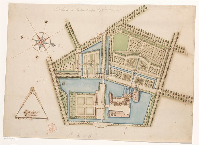
Map of Rosendael Castle, c.1650-before 1722. Creator: Anon.
| px | px | dpi | = | cm | x | cm | = | MB |
Details
Creative#:
TOP29405652
Source:
達志影像
Authorization Type:
RM
Release Information:
須由TPG 完整授權
Model Release:
Not Required
Property Release:
Not Required
Right to Privacy:
No
Same folder images:
EuropenorthbuildinghistoricalgardenartsmapartviewmuseumNetherlandsDutchcastlecolorscalenorthernfortificationsfortificationgroundsdirectioncenturydrawingestatemeasurementMOATconceptcompassmeasurementsaerialview17thcenturyColourbirdseyeviewcompassrosemagneticnorth18thcenturyEighteenthCenturyhistoryhistoricseventeenthcenturyRijksmuseumTGNinkAnonAnonymouspaperHeritageArtDrawingLowCountriesscaledrawingwatercolour(paint)RosendaelCastle
(paint)17th18thAnonAnonymousArtCastleCenturyColourCountriesDrawingDutchEighteenthEuropeHeritageLowMOATNetherlandsRijksmuseumRosendaelTGNaerialartartsbirdsbuildingcastlecenturycenturycenturycenturycolorcompasscompassconceptdirectiondrawingdrawingestateeyefortificationfortificationsgardengroundshistorichistoricalhistoryinkmagneticmapmeasurementmeasurementsmuseumnorthnorthnorthernpaperrosescalescaleseventeenthviewviewviewwatercolour
 Loading