
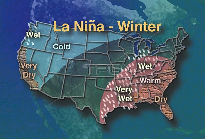
La Ni簽a's effects can be felt throughout the United States through changes in the weather. This map shows the typical weather patterns associated with a La Ni簽a during the winter months. A La Ni簽a event occurs when cooler than normal sea surface temperatures form along the equator in the Pacific Ocean, specifically in the eastern to central Pacific. The La Ni簽a we are experiencing now has a significant presence in the eastern part of the ocean. The cooler water temperatures associated with La Ni簽a are caused by an increase in easterly sea surface winds. Under normal conditions these winds force cooler water from below up to the surface of the ocean. When the winds increase in speed, more cold water from below is forced up, cooling the ocean surface.
| px | px | dpi | = | cm | x | cm | = | MB |
Details
Creative#:
TOP22095673
Source:
達志影像
Authorization Type:
RM
Release Information:
須由TPG 完整授權
Model Release:
N/A
Property Release:
No
Right to Privacy:
No
Same folder images:
 Loading