
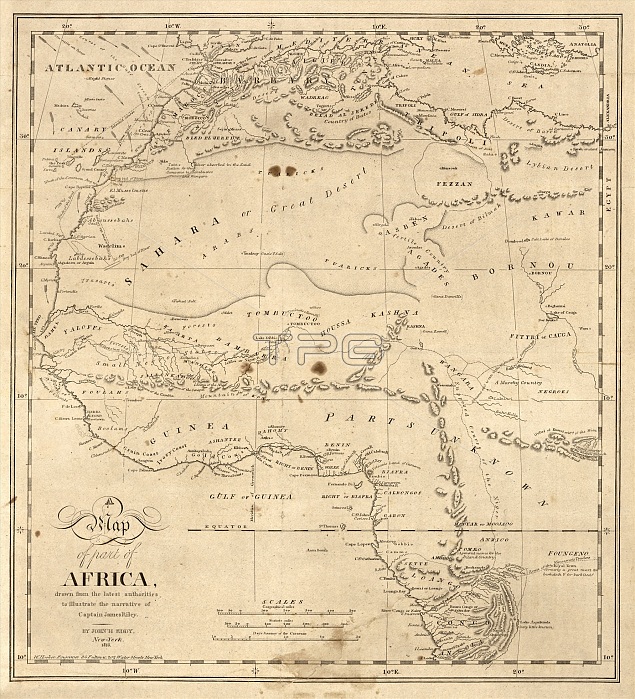
Map of north-western Africa. 19th-century map of the north-western regions of Africa, illustrating the story of the August 1815 shipwreck of the crew of the US merchant ship 'Commerce'. 'Sufferings in Africa' (1817) by Captain James Riley (1777-1840) told of the crew's desert journey, captivity and arrival in Essaouira (Mogador, upper left). At the time, much of the African interior was poorly mapped. The most detailed knowledge was of the North African coast, along the Niger River (across centre) and around the mouth of the Congo River (lower right). Map published in 1816 in New York by US geographer John Hartshorne Eddy (1783-1817).
| px | px | dpi | = | cm | x | cm | = | MB |
Details
Creative#:
TOP16426639
Source:
達志影像
Authorization Type:
RM
Release Information:
須由TPG 完整授權
Model Release:
N/A
Property Release:
N/A
Right to Privacy:
No
Same folder images:
 Loading