
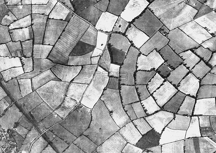
Milton Keynes, historical aerial photograph mosaic taken between 1939 and 1952. The photograph shows mainly farmland a small buildings. This area experienced rapid new development during the 1960's.Between 1939 - 1942 Hitler's Luftwaffe secretly photographed large areas of Great Britain and Ireland for target reconnaissance. From 1946 until 1952 the Royal Air Force began detailed aerial surveys for planning and reconstruction work following the Second World War. Both sources have been used to create these historical aerial maps. See image C017/0653 for the same aerial photograph taken in 2012.
| px | px | dpi | = | cm | x | cm | = | MB |
Details
Creative#:
TOP12391878
Source:
達志影像
Authorization Type:
RM
Release Information:
須由TPG 完整授權
Model Release:
No
Property Release:
No
Right to Privacy:
No
Same folder images:
 Loading