
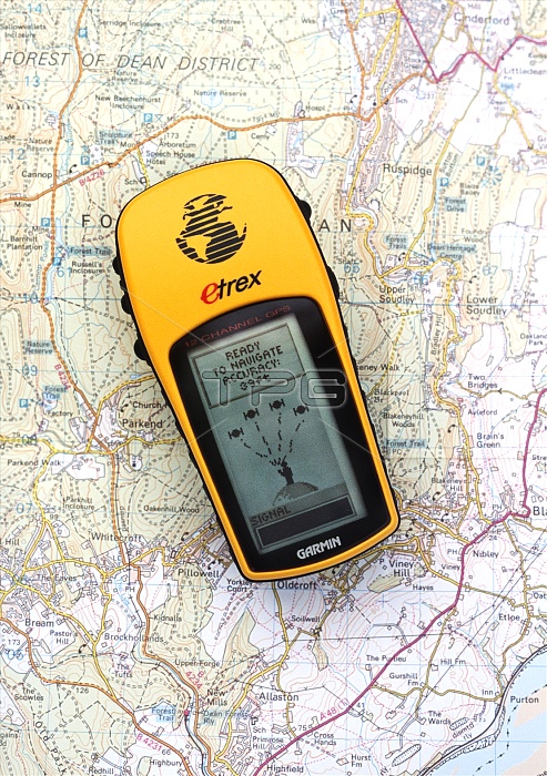
GPS receiver on a map. GPS (Global positioning system) uses a network of satellites to calculate the user's location on Earth. Each satellite sends a signal that is detected by the handset, and it calculates its position by triangulation. This handset is showing a position accuracy of 39 feet (just under ten metres). GPS is often used by recreational walkers and ramblers.
| px | px | dpi | = | cm | x | cm | = | MB |
Details
Creative#:
TOP10231912
Source:
達志影像
Authorization Type:
RM
Release Information:
須由TPG 完整授權
Model Release:
N/A
Property Release:
N/A
Right to Privacy:
No
Same folder images:
 Loading